|
search place name
|
||
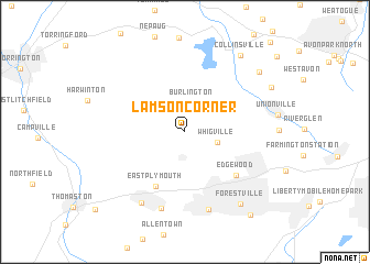
Lamson Corner (Connecticut, United States - USA)Lamson Corner is a town in the Connecticut region of United States - USA. An overview map of the region around Lamson Corner is displayed below.
regional and 3d topo map of Lamson Corner, United States - USA ::
Lamson Corner airports ::
The nearest airport is HFD - Hartford Brainard, located 26.8 km east of Lamson Corner.
Other airports nearby include BDL - Windsor Locks Bradley Intl (32.4 km north east), CEF - Chicopee Falls Westover Arb Metropolitan (61.9 km north east), BDR - Stratford Igor I Sikorsky Mem (65.6 km south), HPN - White Plains Westchester Co (97.0 km south west), Nearby towns ::
Burlington (3.0km north) //
Whigville (2.6km south east) //
East Plymouth (5.9km south) //
Edgewood (5.9km south east) //
Pequabuck (8.0km south) //
Bristol (8.1km south) //
Terryville (7.9km south west) //
Forestville (8.5km south east) //
Collinsville (8.9km north east) //
Huckleberry Hills Trails (8.3km north east) //
Lovely Street (7.9km north east) //
East Bristol (9.8km south east) //
[all distances 'as the bird flies' and approximate] 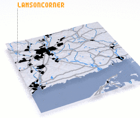 Places with similar names to Lamson Corner, United States - USA :: Disclaimer :: Information on this page comes without warranty of any kind |
||
|
Where is Lamson Corner? Elevation and coordinates ::
Latitude (lat): 41°44'33"N Longitude (lon): 72°58'18"W
Elevation (approx.): 219m (map arrows pan, magnifying glasses zoom) |
||
|
Visiting Lamson Corner? Hotel/Accommodation ::
Book a hotel in Lamson Corner Travel Guide ::
rental cars ::
car rental offers GPS waypoint ::
download a GPX waypoint (PoI) of Lamson Corner for your GPS receiver
|
||