|
search place name
|
||
Mixville (Connecticut, United States - USA)Mixville is a town in the Connecticut region of United States - USA. An overview map of the region around Mixville is displayed below.
regional and 3d topo map of Mixville, United States - USA ::

Mixville airports ::
The nearest airport is HFD - Hartford Brainard, located 33.7 km north east of Mixville.
Other airports nearby include BDR - Stratford Igor I Sikorsky Mem (42.9 km south), BDL - Windsor Locks Bradley Intl (50.8 km north east), CEF - Chicopee Falls Westover Arb Metropolitan (81.7 km north east), ISP - Islip Long Island Mac Arthur (81.9 km south), Nearby towns ::
West Cheshire (1.9km south east) //
Deaconwood (2.6km south east) //
Cheshire (3.9km south east) //
Marion (4.7km north) //
Prospect (4.2km south west) //
Honeypot Glen (4.1km east) //
Richards Corner (5.1km south east) //
Mountaincrest (5.8km south) //
East Farms (4.7km north west) //
Strathmore Woods (5.3km south east) //
Fox Hollow (4.6km east) //
Brooksvale (6.1km south) //
Milldale (6.1km north east) //
Ives Corner (6.6km south) //
Autumn HIll (5.3km east) //
Meadowbrook (6.0km south east) //
Platts Knoll (6.3km south east) //
Fox Hollow (5.7km east) //
Woodtick (7.2km north west) //
Fair Lawn (6.2km north west) //
Fernwood Estates (7.7km south) //
Plantsville (7.7km north east) //
Pondside (6.4km east) //
East Mountain (6.5km west) //
Bethany Wood (8.5km south west) //
Stillmans Corner (7.4km north east) //
Mill Plain (7.4km north west) //
Valley Mobile Home Park (8.1km south west) //
Bishops Corner (8.6km north east) //
[all distances 'as the bird flies' and approximate] 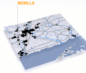 Places with similar names to Mixville, United States - USA ::
// Meeksville (US)
// Maxville (US)
// Maxeyville (US)
// Maxville (US)
// Mikesville (US)
// Maxville (US)
// Maxville (US)
// Macksville (US)
// Myksvoll (NO)
// Maxville (US)
Disclaimer :: Information on this page comes without warranty of any kind |
||
|
Where is Mixville? Elevation and coordinates ::
Latitude (lat): 41°31'20"N Longitude (lon): 72°56'10"W
Elevation (approx.): 67m (map arrows pan, magnifying glasses zoom) |
||
|
Visiting Mixville? Hotel/Accommodation ::
Book a hotel in Mixville Travel Guide ::
rental cars ::
car rental offers GPS waypoint ::
download a GPX waypoint (PoI) of Mixville for your GPS receiver
|
||