|
search place name
|
||
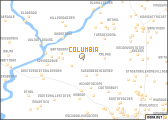
Columbia (Delaware, United States - USA)Columbia is a town in the Delaware region of United States - USA. An overview map of the region around Columbia is displayed below.
regional and 3d topo map of Columbia, United States - USA ::
Columbia airports ::
The nearest airport is SBY - Salisbury Ocean City Wicomico Rgnl, located 22.8 km south east of Columbia.
Other airports nearby include NHK - Patuxent River Nas (68.3 km west), DOV - Dover Afb (72.5 km north), WWD - Wildwood Cape May Co (87.7 km north east), ADW - Camp Springs Andrews Afb (Washington Dc Naf) (109.2 km west), Nearby towns ::
Norfolk Downs (2.4km south west) //
Packing House Corner (3.6km south) //
Susan Beach Corner (4.0km south east) //
Ralphs (3.6km east) //
Matyiko Manor (3.7km west) //
Santo Domingo (4.2km west) //
Cooper Mill (4.4km west) //
Hickory Acres (6.3km south) //
Tussock Pond (5.9km north east) //
Sharptown (6.2km north west) //
Elliots Place (6.8km south) //
Riverton Acres (5.7km west) //
White River Estates (7.6km north) //
Edgewood Park (8.1km south) //
Spring Grove (6.5km west) //
Galestown (8.3km north west) //
Riverton (6.8km west) //
Hebron (8.7km south) //
River-view Acres (8.3km north east) //
Portsville (8.3km north east) //
Canterbury (8.3km south east) //
Baileys Landing (8.8km north) //
Broad Creek Estates (8.9km north east) //
Millpond Acres (9.4km north west) //
Bethel (9.6km north east) //
Jersey Road Estates (9.7km south east) //
Porter Mill Estates (10.3km south west) //
[all distances 'as the bird flies' and approximate] 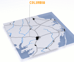 Places with similar names to Columbia, United States - USA ::
Disclaimer :: Information on this page comes without warranty of any kind |
||
|
Where is Columbia? Elevation and coordinates ::
Latitude (lat): 38°29'52"N Longitude (lon): 75°40'41"W
Elevation (approx.): 12m (map arrows pan, magnifying glasses zoom) |
||
|
Visiting Columbia? Hotel/Accommodation ::
Book a hotel in Columbia Travel Guide ::
rental cars ::
car rental offers GPS waypoint ::
download a GPX waypoint (PoI) of Columbia for your GPS receiver
|
||