|
search place name
|
||
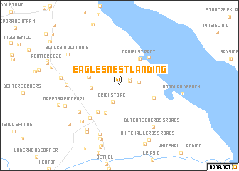
Eagles Nest Landing (Delaware, United States - USA)Eagles Nest Landing is a town in the Delaware region of United States - USA. An overview map of the region around Eagles Nest Landing is displayed below.
regional and 3d topo map of Eagles Nest Landing, United States - USA ::
Eagles Nest Landing airports ::
The nearest airport is DOV - Dover Afb, located 25.4 km south of Eagles Nest Landing.
Other airports nearby include ILG - Wilmington New Castle (37.2 km north), MIV - Millville Muni (42.4 km east), APG - Aberdeen Phillips Aaf (53.8 km west), PHL - Philadelphia Intl (64.7 km north east), Nearby towns ::
Hay Point Landing (1.5km north east) //
Flemings Landing (1.6km north east) //
Chambersville (2.4km north west) //
Brick Store (2.7km south) //
Shorts Landing (2.4km east) //
Deakyneville (3.1km north east) //
Walker (3.4km west) //
Woodland Court Mobile Home Park (4.6km south) //
Tent (3.9km west) //
Daniels Tract (4.9km north east) //
Smyrna Landing (4.9km south west) //
Taylors Gut Landing (4.6km south east) //
Collins Beach (5.7km north east) //
Smyrna (6.2km south west) //
Long Point Landing (6.5km south west) //
Spruance City (7.3km south west) //
Lawndale (8.0km south) //
Alisa Estates (6.4km west) //
Dutch Neck Crossroads (7.7km south east) //
Colmar Manor (7.9km south west) //
Hedgerow Hollow Mobile Home Park (8.6km south) //
Big Oak Corners (8.7km south) //
Cedarbrook Acres (8.4km south west) //
Green Spring Farm (7.4km south west) //
Blackbird Landing (7.9km north west) //
Whitehall Crossroads (9.3km south east) //
Clayton (8.6km south west) //
[all distances 'as the bird flies' and approximate] 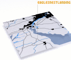 Places with similar names to Eagles Nest Landing, United States - USA :: Disclaimer :: Information on this page comes without warranty of any kind |
||
|
Where is Eagles Nest Landing? Elevation and coordinates ::
Latitude (lat): 39°20'43"N Longitude (lon): 75°33'49"W
Elevation (approx.): 4m (map arrows pan, magnifying glasses zoom) |
||
|
Visiting Eagles Nest Landing? Hotel/Accommodation ::
Book a hotel in Eagles Nest Landing Travel Guide ::
rental cars ::
car rental offers GPS waypoint ::
download a GPX waypoint (PoI) of Eagles Nest Landing for your GPS receiver
|
||