|
search place name
|
||
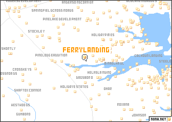
Ferry Landing (Delaware, United States - USA)Ferry Landing is a town in the Delaware region of United States - USA. An overview map of the region around Ferry Landing is displayed below.
regional and 3d topo map of Ferry Landing, United States - USA ::
Ferry Landing airports ::
The nearest airport is SBY - Salisbury Ocean City Wicomico Rgnl, located 36.3 km south west of Ferry Landing.
Other airports nearby include WWD - Wildwood Cape May Co (54.7 km north east), DOV - Dover Afb (62.7 km north), MIV - Millville Muni (87.4 km north), NHK - Patuxent River Nas (107.4 km west), Nearby towns ::
Warwick (1.7km north east) //
Bullseye (1.8km east) //
Hillcrest Acres Mobile Home Park (2.3km north east) //
Sandy Beach (2.3km south west) //
Burton Acres (2.4km south west) //
Old Landing (2.4km west) //
Pinepoint Mobile Home Park (2.3km east) //
Holiday Acres (2.9km south west) //
The Landing (2.6km east) //
Riverview (2.9km west) //
Warwick Park (3.0km east) //
Gull Point (3.0km east) //
Buck Hill Landing (4.1km south east) //
Indiantown Farms (4.2km north east) //
Dagsboro (4.8km south) //
Helms Landing (4.4km south east) //
Kerseys Evergreen Acres (4.2km south west) //
Millsboro (4.1km west) //
Harmon (4.4km north east) //
Oak Meadows Mobile Home Park (4.4km north east) //
Prince George Acres (5.3km south) //
River Village II Mobile Home Park (4.5km north east) //
Oak Orchard West Mobile Home Park (4.6km north east) //
Driftwood Village Mobile Home Park (4.6km north east) //
Riverdale (4.6km east) //
River Village Mobile Home Park (5.0km north east) //
Holiday Pines Mobile Home Park (5.6km north east) //
Holiday Pines (5.6km north east) //
Thatchers Landing (5.4km south east) //
[all distances 'as the bird flies' and approximate]  Places with similar names to Ferry Landing, United States - USA ::
// Fair Landing (US)
// Ferry Landing (US)
Disclaimer :: Information on this page comes without warranty of any kind |
||
|
Where is Ferry Landing? Elevation and coordinates ::
Latitude (lat): 38°35'32"N Longitude (lon): 75°14'40"W
Elevation (approx.): -32768m (map arrows pan, magnifying glasses zoom) |
||
|
Visiting Ferry Landing? Hotel/Accommodation ::
Book a hotel in Ferry Landing Travel Guide ::
rental cars ::
car rental offers GPS waypoint ::
download a GPX waypoint (PoI) of Ferry Landing for your GPS receiver
|
||