|
search place name
|
||
Hollingsworth Development (Delaware, United States - USA)Hollingsworth Development is a town in the Delaware region of United States - USA. An overview map of the region around Hollingsworth Development is displayed below.
regional and 3d topo map of Hollingsworth Development, United States - USA ::

Hollingsworth Development airports ::
The nearest airport is ILG - Wilmington New Castle, located 16.4 km south of Hollingsworth Development.
Other airports nearby include PHL - Philadelphia Intl (32.6 km east), NXX - Willow Grove Nas Jrb (57.7 km north east), APG - Aberdeen Phillips Aaf (61.9 km south west), MIV - Millville Muni (69.1 km south east), Nearby towns ::
Delaware Heights (0.3km west) //
Centerville (0.5km south) //
Pentland (1.6km west) //
Owls Nest (1.9km south west) //
Fairville (2.3km north west) //
Norway (2.6km north) //
Walnut Ridge (2.8km south west) //
Cossart (2.9km north east) //
Granogue (2.7km east) //
Guyencourt (3.0km south east) //
Burnt Mills (3.0km west) //
Brookfield (3.5km north east) //
Winterthur (3.4km south east) //
Swallow Hill (3.9km south west) //
Mendenhall (3.7km north west) //
West Farm (4.4km south) //
Mount Cuba (4.3km south west) //
Chadds Ford Knoll (4.7km north) //
Montchanin (4.7km south east) //
Greenville Development (5.1km south) //
Ashland (4.5km south west) //
Chadds Ford Junction (5.1km north) //
Rockland Woods (4.7km south east) //
Greenville Manor (5.3km south) //
Nanticoke Farms (5.5km south) //
Greenville (5.5km south) //
Rosedale (4.7km north west) //
Chadds Ford (5.6km north east) //
Barley Woods (5.9km south) //
[all distances 'as the bird flies' and approximate] 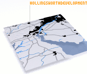 Places with similar names to Hollingsworth Development, United States - USA :: Disclaimer :: Information on this page comes without warranty of any kind |
||
|
Where is Hollingsworth Development? Elevation and coordinates ::
Latitude (lat): 39°49'33"N Longitude (lon): 75°37'3"W
Elevation (approx.): 133m (map arrows pan, magnifying glasses zoom) |
||
|
Visiting Hollingsworth Development? Hotel/Accommodation ::
Book a hotel in Hollingsworth Development Travel Guide ::
rental cars ::
car rental offers GPS waypoint ::
download a GPX waypoint (PoI) of Hollingsworth Development for your GPS receiver
|
||