|
search place name
|
||
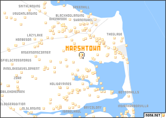
Marshtown (Delaware, United States - USA)Marshtown is a town in the Delaware region of United States - USA. An overview map of the region around Marshtown is displayed below.
regional and 3d topo map of Marshtown, United States - USA ::
Marshtown airports ::
The nearest airport is WWD - Wildwood Cape May Co, located 41.4 km north east of Marshtown.
Other airports nearby include SBY - Salisbury Ocean City Wicomico Rgnl (49.4 km south west), DOV - Dover Afb (55.0 km north west), MIV - Millville Muni (75.3 km north), ACY - Atlantic City Intl (98.9 km north east), Nearby towns ::
Tri-State Mobile Home Park (0.6km north west) //
Woods Edge (0.9km north) //
Fox Hollow (1.1km north west) //
Bay Shore Hills (1.7km east) //
The Willows (1.9km south west) //
Angola Acres II Mobile Home Park (2.3km south) //
Robinson Landing (1.9km east) //
Fisher Landing (2.3km north west) //
Webb Landing (2.5km north west) //
Angola by the Bay (2.7km south) //
Angola Crest Mobile Home Park (2.7km south) //
Angola Neck Park Mobile Home Park (2.7km south east) //
Country Village (2.8km north east) //
Angola Crest II Mobile Home Park (2.9km south) //
Old Landing Woods (2.8km east) //
Bookhammer Landing (3.0km south east) //
Conley Chapel Village Mobile Home Park (3.0km west) //
John Marsh Landing (3.9km south) //
Robinsonville (3.3km north west) //
The Woods on Herring Creek (3.6km south east) //
Long Acres (3.4km north west) //
Lochwood (3.2km south west) //
Goslee Mill (3.5km north west) //
Pine Water Farm (3.8km south) //
Holly Pines Mobile Home Park (3.8km north west) //
Ben Robins Landing (4.0km south) //
West Bay Park Mobile Home Park (3.8km south east) //
Old Landing (3.2km east) //
Shell Landing (3.7km south east) //
[all distances 'as the bird flies' and approximate]  Places with similar names to Marshtown, United States - USA ::
Disclaimer :: Information on this page comes without warranty of any kind |
||
|
Where is Marshtown? Elevation and coordinates ::
Latitude (lat): 38°41'36"N Longitude (lon): 75°9'51"W
Elevation (approx.): 6m (map arrows pan, magnifying glasses zoom) |
||
|
Visiting Marshtown? Hotel/Accommodation ::
Book a hotel in Marshtown Travel Guide ::
rental cars ::
car rental offers GPS waypoint ::
download a GPX waypoint (PoI) of Marshtown for your GPS receiver
|
||