|
search place name
|
||
Pinehurst Circle (District of Columbia, United States - USA)Pinehurst Circle is a town in the District of Columbia region of United States - USA. An overview map of the region around Pinehurst Circle is displayed below.
regional and 3d topo map of Pinehurst Circle, United States - USA ::

Pinehurst Circle airports ::
The nearest airport is DCA - Ronald Reagan Washington Natl, located 13.7 km south of Pinehurst Circle.
Other airports nearby include ADW - Camp Springs Andrews Afb (Washington Dc Naf) (25.7 km south east), IAD - Washington Dulles Intl (32.7 km west), BWI - Baltimore Washington Intl (42.3 km north east), NHK - Patuxent River Nas (95.8 km south east), Nearby towns ::
Chevy Chase Village (0.2km south east) //
Chevy Chase (0.3km east) //
Chevy Chase Section Three (1.1km north east) //
Friendship Heights (1.1km south west) //
Chevy Chase Heights (1.3km south) //
Friendship Village (1.2km south west) //
Martins Additions (1.3km north east) //
Chevy Chase Terrace (1.2km west) //
Friendship Heights (1.5km south) //
Chevy Chase Section Five (1.5km north) //
Chevy Chase (1.3km south east) //
Somerset Heights (1.3km west) //
Martins Addition (1.5km north east) //
Chevy Chase Manor (1.5km north east) //
Brookdale (1.6km south west) //
Somerset (1.5km west) //
Rollingwood (1.7km north east) //
The Hamlet (1.9km north) //
Drummond (1.5km west) //
Reno (2.0km south) //
Columbia Forest (2.2km north) //
Barnaby Woods (1.8km east) //
Westboro (2.3km north west) //
Green Acres (2.0km south west) //
Glen Cove (2.1km south west) //
American University Park (2.3km south) //
Tenleytown (2.4km south) //
Bethesda (2.0km north west) //
West Chevy Chase Heights (2.5km north) //
[all distances 'as the bird flies' and approximate] 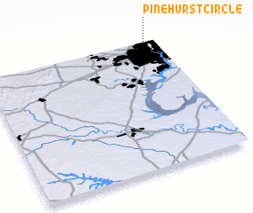 Places with similar names to Pinehurst Circle, United States - USA :: Disclaimer :: Information on this page comes without warranty of any kind |
||
|
Where is Pinehurst Circle? Elevation and coordinates ::
Latitude (lat): 38°58'15"N Longitude (lon): 77°4'50"W
Elevation (approx.): 105m (map arrows pan, magnifying glasses zoom) |
||
|
Visiting Pinehurst Circle? Hotel/Accommodation ::
Book a hotel in Pinehurst Circle Travel Guide ::
rental cars ::
car rental offers GPS waypoint ::
download a GPX waypoint (PoI) of Pinehurst Circle for your GPS receiver
|
||