|
search place name
|
||
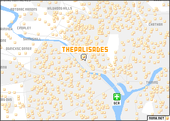
The Palisades (District of Columbia, United States - USA)The Palisades is a town in the District of Columbia region of United States - USA. An overview map of the region around The Palisades is displayed below.
regional and 3d topo map of The Palisades, United States - USA ::
The Palisades airports ::
The nearest airport is DCA - Ronald Reagan Washington Natl, located 9.8 km south east of The Palisades.
Other airports nearby include ADW - Camp Springs Andrews Afb (Washington Dc Naf) (24.0 km south east), IAD - Washington Dulles Intl (30.8 km west), BWI - Baltimore Washington Intl (46.7 km north east), NHK - Patuxent River Nas (93.0 km south east), Nearby towns ::
Potomac Heights (0.6km north west) //
Foxhall (0.7km south east) //
Kent (1.0km north) //
Foxhall Crescent (0.8km east) //
Spring Valley (1.6km north) //
Wesley Heights (1.3km north east) //
Senate Heights (1.5km south east) //
Bellevue Forest (1.6km south west) //
Rivercrest (1.6km west) //
Beechwood Hills (1.9km south west) //
Colony Hill (1.8km south east) //
Dover (2.1km south) //
Westover Place (1.8km north east) //
Riverwood (2.2km south) //
Arlingwood (1.8km west) //
Sutton Place (1.8km north east) //
Embassy Park (2.0km north east) //
Indian Rock Terrace (2.2km south east) //
Foxhall Village (2.1km south east) //
Westchester (1.9km east) //
Crystal Spring Knolls (2.4km south) //
Westmoreland Terrace (2.5km north) //
Broyhill Forest (2.1km south west) //
Cathedral Heights (2.1km east) //
Little Indian Rock Terrace (2.4km south east) //
Westmoreland Hills (2.7km north) //
Glover Park (2.1km east) //
Woodmont (2.8km south) //
Brookmont (2.5km north west) //
[all distances 'as the bird flies' and approximate] 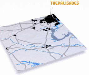 Places with similar names to The Palisades, United States - USA :: Disclaimer :: Information on this page comes without warranty of any kind |
||
|
Where is The Palisades? Elevation and coordinates ::
Latitude (lat): 38°55'30"N Longitude (lon): 77°6'6"W
Elevation (approx.): 47m (map arrows pan, magnifying glasses zoom) |
||
|
Visiting The Palisades? Hotel/Accommodation ::
Book a hotel in The Palisades Travel Guide ::
rental cars ::
car rental offers GPS waypoint ::
download a GPX waypoint (PoI) of The Palisades for your GPS receiver
|
||