|
search place name
|
||
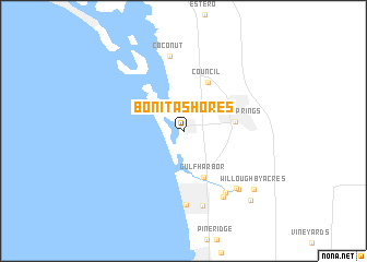
Bonita Shores (Florida, United States - USA)Bonita Shores is a town in the Florida region of United States - USA. An overview map of the region around Bonita Shores is displayed below.
regional and 3d topo map of Bonita Shores, United States - USA ::
Bonita Shores airports ::
The nearest airport is RSW - Fort Myers Southwest Florida Intl, located 23.9 km north of Bonita Shores.
Other airports nearby include MIA - Miami Intl (164.9 km east), FLL - Fort Lauderdale Hollywood Intl (169.8 km east), HST - Homestead Arb (172.1 km south east), PBI - West Palm Beach Palm Beach Intl (177.0 km east), Nearby towns ::
Gulf Harbor (5.1km south) //
Bonita Springs (4.9km east) //
Council (5.5km north east) //
Vanderbilt Beach Estates (7.5km south) //
Palm River Shores (7.4km south east) //
Coconut (7.7km north) //
Vanderbilt Beach (7.6km south east) //
Naples Park (7.9km south) //
Palm River Estates (7.6km south east) //
Palm River (7.8km south east) //
Willoughby Acres (8.8km south east) //
Four Seasons (9.4km south east) //
[all distances 'as the bird flies' and approximate] 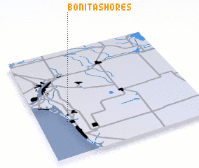 Places with similar names to Bonita Shores, United States - USA ::
// Band-e Shīrāz (IR)
// Bonnet Shores (US)
Disclaimer :: Information on this page comes without warranty of any kind |
||
|
Where is Bonita Shores? Elevation and coordinates ::
Latitude (lat): 26°19'50"N Longitude (lon): 81°49'37"W
Elevation (approx.): 7m (map arrows pan, magnifying glasses zoom) |
||
|
Visiting Bonita Shores? Hotel/Accommodation ::
Book a hotel in Bonita Shores Travel Guide ::
rental cars ::
car rental offers GPS waypoint ::
download a GPX waypoint (PoI) of Bonita Shores for your GPS receiver
|
||