|
search place name
|
||
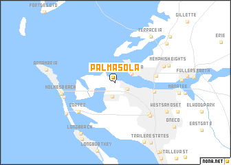
Palma Sola (Florida, United States - USA)Palma Sola is a town in the Florida region of United States - USA. An overview map of the region around Palma Sola is displayed below.
regional and 3d topo map of Palma Sola, United States - USA ::
Palma Sola airports ::
The nearest airport is MCF - Tampa Macdill Afb, located 39.0 km north of Palma Sola.
Other airports nearby include PIE - St. Petersburg St Petersburg Clearwater Intl (44.5 km north), TPA - Tampa Intl (52.3 km north), RSW - Fort Myers Southwest Florida Intl (138.8 km south east), MCO - Orlando Intl (165.2 km north east), Nearby towns ::
West Bradenton (2.1km south east) //
Palma Sola Park (2.3km south) //
Terra Mana (2.7km north east) //
Bradenton (5.8km east) //
Palmetto (6.0km east) //
Cedar Hammock (7.0km south east) //
Cortez (7.2km south west) //
South Bradenton (7.4km south east) //
Memphis (7.5km east) //
Ilexhurst (7.8km west) //
Holmes Beach (8.0km west) //
Memphis Heights (8.1km east) //
Terra Ceia (9.0km north east) //
Bradenton Beach (8.7km south west) //
West Samoset (8.8km south east) //
Longbeach (9.7km south west) //
Palm View (9.7km north east) //
Rubonia (10.8km north east) //
[all distances 'as the bird flies' and approximate] 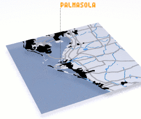 Places with similar names to Palma Sola, United States - USA ::
// Palma Sola (CU)
// Palma Sola (CU)
// Palma Sola (CU)
// Palma Sola (CU)
// Palma Sola (CU)
// Palmasol (CO)
// Palmasola (CO)
// Palmasola (CO)
// Palma Sola (EC)
// Palma Sola (MX)
Disclaimer :: Information on this page comes without warranty of any kind |
||
|
Where is Palma Sola? Elevation and coordinates ::
Latitude (lat): 27°30'43"N Longitude (lon): 82°37'56"W
Elevation (approx.): 7m (map arrows pan, magnifying glasses zoom) |
||
|
Visiting Palma Sola? Hotel/Accommodation ::
Book a hotel in Palma Sola Travel Guide ::
rental cars ::
car rental offers GPS waypoint ::
download a GPX waypoint (PoI) of Palma Sola for your GPS receiver
|
||