|
search place name
|
||
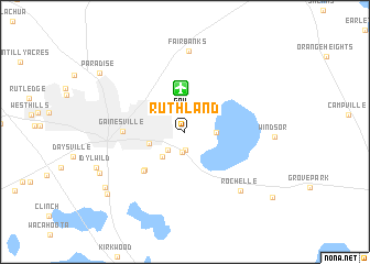
Ruthland (Florida, United States - USA)Ruthland is a town in the Florida region of United States - USA. An overview map of the region around Ruthland is displayed below.
regional and 3d topo map of Ruthland, United States - USA ::
Ruthland airports ::
The nearest airport is GNV - Gainesville Rgnl, located 4.4 km north of Ruthland.
Other airports nearby include NIP - Jacksonville Nas (86.2 km north east), JAX - Jacksonville Intl (109.0 km north east), MCO - Orlando Intl (164.5 km south east), VAD - Valdosta Moody Afb (171.0 km north west), Nearby towns ::
Green Grove (1.9km south) //
Kreftwood Estates (2.1km south) //
Kincaid Hills (2.4km south west) //
Newnans Lake Homesites (2.7km east) //
Lakeview Estates (3.2km south west) //
Copeland Settlement (3.6km north east) //
Lincoln Estates (3.4km west) //
Melton Manor (5.2km south west) //
Robinson Heights (5.3km south west) //
Gainesville (5.5km west) //
Rochelle (7.7km south east) //
Fairbanks (8.2km north) //
South Idylwild (8.7km south west) //
Malore Gardens (9.1km south west) //
Rocky Point (9.3km south west) //
Paradise (9.6km north west) //
Phifer (10.2km south east) //
[all distances 'as the bird flies' and approximate]  Places with similar names to Ruthland, United States - USA :: Disclaimer :: Information on this page comes without warranty of any kind |
||
|
Where is Ruthland? Elevation and coordinates ::
Latitude (lat): 29°39'2"N Longitude (lon): 82°16'5"W
Elevation (approx.): 41m (map arrows pan, magnifying glasses zoom) |
||
|
Visiting Ruthland? Hotel/Accommodation ::
Book a hotel in Ruthland Travel Guide ::
rental cars ::
car rental offers GPS waypoint ::
download a GPX waypoint (PoI) of Ruthland for your GPS receiver
|
||