|
search place name
|
||
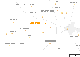
Sherman Oaks (Florida, United States - USA)Sherman Oaks is a town in the Florida region of United States - USA. An overview map of the region around Sherman Oaks is displayed below.
regional and 3d topo map of Sherman Oaks, United States - USA ::
Sherman Oaks airports ::
The nearest airport is GNV - Gainesville Rgnl, located 55.5 km north of Sherman Oaks.
Other airports nearby include MCO - Orlando Intl (125.1 km south east), NIP - Jacksonville Nas (128.7 km north east), TPA - Tampa Intl (137.2 km south), PIE - St. Petersburg St Petersburg Clearwater Intl (147.9 km south), Nearby towns ::
Martel (1.0km east) //
Ocala Thoroughbred Acres (2.3km south east) //
Mount Olive (3.1km north west) //
Ocala Ridge (4.1km east) //
Golden Hills (5.5km north) //
Ocala Estates (5.4km west) //
York (6.1km south west) //
Cotton Plant (6.2km west) //
Fellowship (7.3km north west) //
Ocala Park Ranch (7.8km north east) //
Bahia Oaks (8.0km south east) //
Saddle Oak Club (8.1km south east) //
Rolling Hills (11.1km south west) //
Zuber (11.3km north east) //
[all distances 'as the bird flies' and approximate] 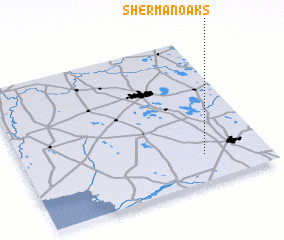 Places with similar names to Sherman Oaks, United States - USA ::
// Sherman Oaks (US)
Disclaimer :: Information on this page comes without warranty of any kind |
||
|
Where is Sherman Oaks? Elevation and coordinates ::
Latitude (lat): 29°11'22"N Longitude (lon): 82°15'22"W
Elevation (approx.): 31m (map arrows pan, magnifying glasses zoom) |
||
|
Visiting Sherman Oaks? Hotel/Accommodation ::
Book a hotel in Sherman Oaks Travel Guide ::
rental cars ::
car rental offers GPS waypoint ::
download a GPX waypoint (PoI) of Sherman Oaks for your GPS receiver
|
||