|
search place name
|
||
Akins Mill (Georgia, United States - USA)Akins Mill is a town in the Georgia region of United States - USA. An overview map of the region around Akins Mill is displayed below.
regional and 3d topo map of Akins Mill, United States - USA ::

Akins Mill airports ::
The nearest airport is SAV - Savannah Hilton Head Intl, located 72.0 km south east of Akins Mill.
Other airports nearby include SVN - Hunter Aaf (84.4 km south east), AGS - Bush Field Augusta Rgnl At Bush Fld (95.9 km north), NBC - Beaufort Mcas (102.8 km east), WRB - Macon Robins Afb (167.3 km west), Nearby towns ::
Hopeulikit (3.3km west) //
Deerfield (4.3km south east) //
Westchester (4.7km south east) //
Georgian Walk (4.4km south east) //
Foxlake (5.1km south east) //
Huntington (4.8km south east) //
Quail Run (6.1km south) //
Northwood (5.6km south east) //
Clito (5.8km east) //
Statesboro (7.9km south east) //
Country Club Estates (9.0km south) //
Blitch (8.9km north) //
Oakcrest (8.7km south east) //
Brians Chase (9.3km south east) //
Windfield (9.8km south east) //
[all distances 'as the bird flies' and approximate] 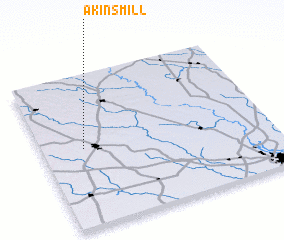 Places with similar names to Akins Mill, United States - USA :: Disclaimer :: Information on this page comes without warranty of any kind |
||
|
Where is Akins Mill? Elevation and coordinates ::
Latitude (lat): 32°30'51"N Longitude (lon): 81°48'58"W
Elevation (approx.): 59m (map arrows pan, magnifying glasses zoom) |
||
|
Visiting Akins Mill? Hotel/Accommodation ::
Book a hotel in Akins Mill Travel Guide ::
rental cars ::
car rental offers GPS waypoint ::
download a GPX waypoint (PoI) of Akins Mill for your GPS receiver
|
||