|
search place name
|
||
Burnt Hickory Acres (Georgia, United States - USA)Burnt Hickory Acres is a town in the Georgia region of United States - USA. An overview map of the region around Burnt Hickory Acres is displayed below.
regional and 3d topo map of Burnt Hickory Acres, United States - USA ::

Burnt Hickory Acres airports ::
The nearest airport is MGE - Marietta Dobbins Arb (Atlanta Nas), located 32.0 km east of Burnt Hickory Acres.
Other airports nearby include ATL - Hartsfield Jackson Atlanta Intl (54.1 km south east), ANB - Anniston Metro (101.8 km south west), CHA - Chattanooga Lovell Fld (122.7 km north), MCN - Macon Middle Georgia Rgnl (180.6 km south east), Nearby towns ::
Forrister (2.0km south east) //
Saddle Up Estates (2.1km north west) //
Windmill Creek (2.5km north west) //
Cobb Estates (3.7km south east) //
Plantation Estates (4.0km south) //
Little Creek Farms (4.3km south west) //
Remus (3.9km north west) //
Westfork (4.5km north east) //
Westward Ho (4.0km east) //
Piney Woods Manor (5.0km south) //
Braswell Corners (4.9km north) //
Dallas (5.1km south) //
McPherson (5.1km south west) //
Pumpkin (5.5km south west) //
Beverly Estates (5.5km east) //
Hanlin (6.0km south west) //
Acorn Tree (6.0km east) //
Brookwood (6.1km east) //
Wood Valley (6.1km east) //
New Hope (6.3km east) //
Hasford Estates (6.5km north east) //
Country Acres (6.4km east) //
White Forest (6.5km east) //
Scoggins Ridge (7.9km south) //
Rock Falls Estates (6.9km south east) //
Sunset Hills (7.5km south east) //
Musket Ridge (7.0km south east) //
Cross Creek (6.9km east) //
Hopecastle Forest (6.9km east) //
[all distances 'as the bird flies' and approximate] 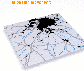 Places with similar names to Burnt Hickory Acres, United States - USA :: Disclaimer :: Information on this page comes without warranty of any kind |
||
|
Where is Burnt Hickory Acres? Elevation and coordinates ::
Latitude (lat): 33°58'2"N Longitude (lon): 84°51'26"W
Elevation (approx.): 274m (map arrows pan, magnifying glasses zoom) |
||
|
Visiting Burnt Hickory Acres? Hotel/Accommodation ::
Book a hotel in Burnt Hickory Acres Travel Guide ::
rental cars ::
car rental offers GPS waypoint ::
download a GPX waypoint (PoI) of Burnt Hickory Acres for your GPS receiver
|
||