|
search place name
|
||
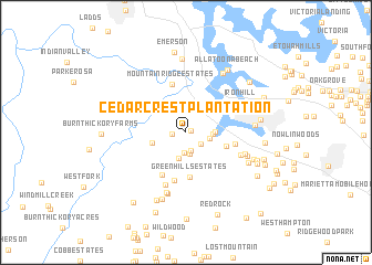
Cedar Crest Plantation (Georgia, United States - USA)Cedar Crest Plantation is a town in the Georgia region of United States - USA. An overview map of the region around Cedar Crest Plantation is displayed below.
regional and 3d topo map of Cedar Crest Plantation, United States - USA ::
Cedar Crest Plantation airports ::
The nearest airport is MGE - Marietta Dobbins Arb (Atlanta Nas), located 26.1 km south east of Cedar Crest Plantation.
Other airports nearby include ATL - Hartsfield Jackson Atlanta Intl (54.8 km south east), ANB - Anniston Metro (115.3 km south west), CHA - Chattanooga Lovell Fld (116.7 km north), MCN - Macon Middle Georgia Rgnl (182.2 km south east), Nearby towns ::
Allatoona Heights (0.5km east) //
Cedar Ridge (1.2km west) //
Jarratt Crossing (1.7km south east) //
Picketts Plantation (1.9km south) //
Picketts Crossing (2.1km south) //
Picketts Mill (2.2km south) //
Allatoona Bay (2.0km east) //
Picketts Creek (2.7km south) //
Falcon Shores (2.3km east) //
North Shores (2.5km east) //
Crowville (3.0km west) //
Hill Forest Estates (3.7km east) //
Green Hills Estates (4.5km south) //
Cross Road Farms (4.8km south west) //
Mountain Ridge Estates (5.0km north) //
Cross Roads (5.0km south) //
Allatoona Ridge (4.3km east) //
Oak Hill (5.5km south) //
Edgewood Estates (5.1km south east) //
Mars Hill (5.4km south east) //
Iron Hill (5.5km north east) //
Roxana (6.3km south) //
Hampton Estates (6.4km south) //
Davenport Trace (5.7km south east) //
Acworth Beach (5.8km east) //
Mars Hill Acres (6.1km south east) //
Allatoona (6.7km north east) //
Mill Creek Station (7.1km south) //
Harris Woods (6.3km south east) //
[all distances 'as the bird flies' and approximate] 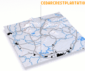 Places with similar names to Cedar Crest Plantation, United States - USA :: Disclaimer :: Information on this page comes without warranty of any kind |
||
|
Where is Cedar Crest Plantation? Elevation and coordinates ::
Latitude (lat): 34°3'15"N Longitude (lon): 84°44'42"W
Elevation (approx.): 248m (map arrows pan, magnifying glasses zoom) |
||
|
Visiting Cedar Crest Plantation? Hotel/Accommodation ::
Book a hotel in Cedar Crest Plantation Travel Guide ::
rental cars ::
car rental offers GPS waypoint ::
download a GPX waypoint (PoI) of Cedar Crest Plantation for your GPS receiver
|
||