|
search place name
|
||
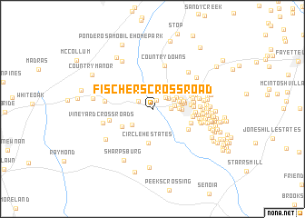
Fischers Crossroad (Georgia, United States - USA)Fischers Crossroad is a town in the Georgia region of United States - USA. An overview map of the region around Fischers Crossroad is displayed below.
regional and 3d topo map of Fischers Crossroad, United States - USA ::
Fischers Crossroad airports ::
The nearest airport is ATL - Hartsfield Jackson Atlanta Intl, located 31.9 km north east of Fischers Crossroad.
Other airports nearby include MGE - Marietta Dobbins Arb (Atlanta Nas) (58.3 km north), ANB - Anniston Metro (117.3 km west), MCN - Macon Middle Georgia Rgnl (119.4 km south east), LSF - Fort Benning Lawson Aaf (122.6 km south), Nearby towns ::
Wynnmeade (1.1km north) //
Shoal Creek Forest (1.7km north west) //
Aberdeen (1.9km north east) //
Peachtree City (1.9km east) //
Woodsmill (2.1km north east) //
Westpark (2.4km east) //
Wisdom Woods (2.5km north east) //
Rocky Shoals Estates (2.9km south west) //
Cobblestone Creek (2.8km north east) //
Twigs Corner (2.7km east) //
The Cloister (2.9km east) //
Pinegate (3.0km north east) //
The Arbors (3.1km east) //
Peachtree Villas (3.1km east) //
Dover Square (3.1km east) //
Saint Andrews Square (3.2km east) //
Spooner Ridge (3.6km north east) //
Tinsley Mill Village (3.4km east) //
Ridgelake (3.4km east) //
Golfview (3.7km north east) //
Circle H Estates (4.3km south) //
Wood Valley Estates (3.9km south west) //
Edgewater (4.0km east) //
Clover Reach (4.3km south east) //
Sweetwater Oaks (4.2km east) //
Rosemont (4.3km east) //
Clover (4.5km south east) //
The Highlands (4.3km east) //
Lakeside (4.3km east) //
[all distances 'as the bird flies' and approximate]  Places with similar names to Fischers Crossroad, United States - USA :: Disclaimer :: Information on this page comes without warranty of any kind |
||
|
Where is Fischers Crossroad? Elevation and coordinates ::
Latitude (lat): 33°23'47"N Longitude (lon): 84°37'0"W
Elevation (approx.): 271m (map arrows pan, magnifying glasses zoom) |
||
|
Visiting Fischers Crossroad? Hotel/Accommodation ::
Book a hotel in Fischers Crossroad Travel Guide ::
rental cars ::
car rental offers GPS waypoint ::
download a GPX waypoint (PoI) of Fischers Crossroad for your GPS receiver
|
||