|
search place name
|
||
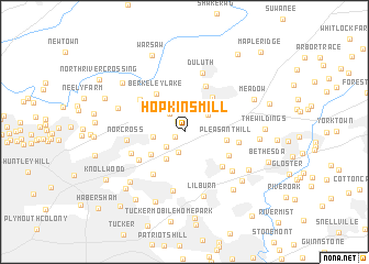
Hopkins Mill (Georgia, United States - USA)Hopkins Mill is a town in the Georgia region of United States - USA. An overview map of the region around Hopkins Mill is displayed below.
regional and 3d topo map of Hopkins Mill, United States - USA ::
Hopkins Mill airports ::
The nearest airport is MGE - Marietta Dobbins Arb (Atlanta Nas), located 33.0 km west of Hopkins Mill.
Other airports nearby include ATL - Hartsfield Jackson Atlanta Intl (42.5 km south west), AND - Andersen Anderson Rgnl (146.8 km north east), MCN - Macon Middle Georgia Rgnl (147.2 km south), CHA - Chattanooga Lovell Fld (154.0 km north west), Nearby towns ::
Berkeley Hills (1.0km south west) //
Covered Bridge (1.3km north west) //
Berkeley Manor (2.1km north) //
Metropolitan Mobile Home Park (2.1km south) //
Norcross Mobile Home City (2.2km north west) //
Indian Crossing (2.2km south west) //
Pittman (2.7km north) //
Adams Crossroads (2.6km north east) //
Edgemoor (2.7km west) //
Jones Mobile Home Park (3.1km south west) //
Steven Hills (3.5km north east) //
Oakbrook Station (3.7km south west) //
Pleasant Hill (3.7km east) //
Cardinal Lake Estates (4.2km north east) //
Berkeley Lake (4.6km north west) //
Forest Manor North (5.0km north) //
Pleasant Acres (4.4km south east) //
Beaver Hills (4.8km south east) //
Stonewood (5.0km south west) //
Springdale Estates (4.8km south west) //
Scotts Mill (5.0km north west) //
Rolling Ridge (4.7km east) //
Sheffield Forest (5.0km south west) //
Norcross (4.9km west) //
Wyloway (6.1km south) //
Burnt Creek (5.7km south east) //
Duluth (6.2km north) //
Lilburn (6.7km south) //
Peachtree Corners (6.1km north west) //
[all distances 'as the bird flies' and approximate]  Places with similar names to Hopkins Mill, United States - USA ::
// Hopkins Mill (US)
Disclaimer :: Information on this page comes without warranty of any kind |
||
|
Where is Hopkins Mill? Elevation and coordinates ::
Latitude (lat): 33°56'55"N Longitude (lon): 84°9'40"W
Elevation (approx.): 296m (map arrows pan, magnifying glasses zoom) |
||
|
Visiting Hopkins Mill? Hotel/Accommodation ::
Book a hotel in Hopkins Mill Travel Guide ::
rental cars ::
car rental offers GPS waypoint ::
download a GPX waypoint (PoI) of Hopkins Mill for your GPS receiver
|
||