|
search place name
|
||
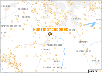
Huntington Creek (Georgia, United States - USA)Huntington Creek is a town in the Georgia region of United States - USA. An overview map of the region around Huntington Creek is displayed below.
regional and 3d topo map of Huntington Creek, United States - USA ::
Huntington Creek airports ::
The nearest airport is ATL - Hartsfield Jackson Atlanta Intl, located 17.7 km north of Huntington Creek.
Other airports nearby include MGE - Marietta Dobbins Arb (Atlanta Nas) (49.2 km north), MCN - Macon Middle Georgia Rgnl (113.7 km south east), WRB - Macon Robins Afb (121.6 km south east), ANB - Anniston Metro (132.9 km west), Nearby towns ::
Ponderosa (0.7km south east) //
Blakely Woods (1.6km south) //
Deer Glen Forest (1.5km south east) //
Cottonwood (1.5km west) //
Wellington Manor (2.7km south east) //
Kenwood Forest (2.9km north east) //
Gamma (3.4km north) //
Kenwood Forest (3.4km north) //
Carnegie Place (3.5km north) //
Kenwood (3.8km north) //
Fayetteville (3.7km south west) //
Greenwood Hills (3.7km north east) //
Morning Creek Estates (3.9km north west) //
Winterthur Woods (3.4km west) //
Fernway Estates (3.5km west) //
Graves Way (3.8km north west) //
Hickory Acres (3.6km west) //
Clayton Ridge (4.2km north) //
Bethesda Woods South (4.3km north west) //
Briarwood Park (4.5km south) //
Park Villas (5.0km north) //
Mundys Mill (4.3km east) //
Ansley Pointe (5.0km north) //
Timberlake (5.2km north) //
Pointe South Place (5.2km north) //
Oak Hills (4.5km north west) //
Wesley Park (5.0km north east) //
North Fayette Estates (5.1km north) //
Helmer (5.5km north) //
[all distances 'as the bird flies' and approximate]  Places with similar names to Huntington Creek, United States - USA :: Disclaimer :: Information on this page comes without warranty of any kind |
||
|
Where is Huntington Creek? Elevation and coordinates ::
Latitude (lat): 33°28'38"N Longitude (lon): 84°26'1"W
Elevation (approx.): 275m (map arrows pan, magnifying glasses zoom) |
||
|
Visiting Huntington Creek? Hotel/Accommodation ::
Book a hotel in Huntington Creek Travel Guide ::
rental cars ::
car rental offers GPS waypoint ::
download a GPX waypoint (PoI) of Huntington Creek for your GPS receiver
|
||