|
search place name
|
||
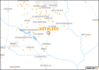
Kathleen (Georgia, United States - USA)Kathleen is a town in the Georgia region of United States - USA. An overview map of the region around Kathleen is displayed below.
regional and 3d topo map of Kathleen, United States - USA ::
Kathleen airports ::
The nearest airport is WRB - Macon Robins Afb, located 16.1 km north of Kathleen.
Other airports nearby include MCN - Macon Middle Georgia Rgnl (22.2 km north), LSF - Fort Benning Lawson Aaf (131.3 km west), ATL - Hartsfield Jackson Atlanta Intl (147.9 km north west), VAD - Valdosta Moody Afb (173.9 km south), Nearby towns ::
Claybed (2.5km north) //
Woodard Estates (3.7km north west) //
Willow Run (3.6km west) //
Sand Bed (4.5km south) //
South Pointe (4.4km north west) //
Bonaire Heights (5.2km north) //
Bonaire (5.4km north) //
South Springs (5.1km north west) //
Lashley (5.6km north) //
Beaver Creek (5.2km west) //
The Heather on Houston Lake (5.5km west) //
Waterford South (5.8km north east) //
Pabst (6.4km south) //
River West (5.9km north east) //
Elmdale Estates (6.8km north west) //
Doublegate (7.1km north west) //
Houston Lake (6.4km west) //
Houston Lake Woods (6.5km west) //
Kings Crossing (7.7km north) //
Hickory Woods (8.0km north) //
Peachtree Estates (8.4km north) //
Forest Pointe (8.6km north) //
Deerwood (8.8km north) //
Windsor Forest (9.0km north) //
Idlewood Acres (8.8km north) //
Holly Bluff (8.9km north) //
Lea Glen (8.3km south west) //
Stathams Landing (8.9km north) //
Shady Grove (7.9km north west) //
[all distances 'as the bird flies' and approximate] 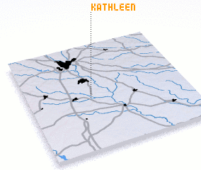 Places with similar names to Kathleen, United States - USA ::
// Kathleen (US)
// Kothulna (IN)
// Goth Allāhno (PK)
// Goth Allana (PK)
// Goth Langha (PK)
// Goth Lāngha (PK)
// Cathleen (ZW)
// Kathleen (CA)
Disclaimer :: Information on this page comes without warranty of any kind |
||
|
Where is Kathleen? Elevation and coordinates ::
Latitude (lat): 32°29'45"N Longitude (lon): 83°36'28"W
Elevation (approx.): 104m (map arrows pan, magnifying glasses zoom) |
||
|
Visiting Kathleen? Hotel/Accommodation ::
Book a hotel in Kathleen Travel Guide ::
rental cars ::
car rental offers GPS waypoint ::
download a GPX waypoint (PoI) of Kathleen for your GPS receiver
|
||