|
search place name
|
||
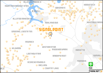
Signal Point (Georgia, United States - USA)Signal Point is a town in the Georgia region of United States - USA. An overview map of the region around Signal Point is displayed below.
regional and 3d topo map of Signal Point, United States - USA ::
Signal Point airports ::
The nearest airport is MGE - Marietta Dobbins Arb (Atlanta Nas), located 15.7 km south east of Signal Point.
Other airports nearby include ATL - Hartsfield Jackson Atlanta Intl (45.7 km south east), ANB - Anniston Metro (121.5 km west), CHA - Chattanooga Lovell Fld (125.1 km north west), MCN - Macon Middle Georgia Rgnl (172.8 km south east), Nearby towns ::
Greyfield North (0.7km south west) //
Valley Hill Estates (0.9km west) //
Country Creek (1.5km north) //
Northwind (1.8km north west) //
Hunt Club (1.7km west) //
Owens Meadows (2.1km north) //
Shiloh West (2.1km north west) //
Kennesaw Acres (2.4km north west) //
Stilesboro Hills (2.2km west) //
Big Shanty Hills (3.1km north) //
Blue Springs (3.5km north west) //
Countryside Estates (3.3km north west) //
Blue Springs Village Mobile Home Park (3.7km north) //
Kennesaw (3.3km north east) //
Etheridge Glen (3.3km west) //
Nowlin Woods (3.9km north) //
Calumet Woods (3.6km north west) //
Whitney Station (3.8km north west) //
Calumet West (4.1km south west) //
Mars Hill Downs (4.0km north west) //
Harris Woods (4.3km north west) //
West Hampton (5.0km south) //
Laurel Hills (4.9km north west) //
North Bend (4.9km north west) //
Mars Hill Acres (4.5km north west) //
Davenport Trace (4.9km north west) //
Marietta Mobile Home Park (4.7km east) //
Davis Crossroads (5.3km south west) //
Mars Hill (5.3km north west) //
[all distances 'as the bird flies' and approximate] 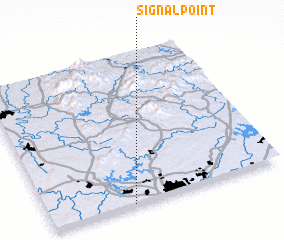 Places with similar names to Signal Point, United States - USA :: Disclaimer :: Information on this page comes without warranty of any kind |
||
|
Where is Signal Point? Elevation and coordinates ::
Latitude (lat): 34°0'25"N Longitude (lon): 84°38'45"W
Elevation (approx.): 342m (map arrows pan, magnifying glasses zoom) |
||
|
Visiting Signal Point? Hotel/Accommodation ::
Book a hotel in Signal Point Travel Guide ::
rental cars ::
car rental offers GPS waypoint ::
download a GPX waypoint (PoI) of Signal Point for your GPS receiver
|
||