|
search place name
|
||
Smoketree (Georgia, United States - USA)Smoketree is a town in the Georgia region of United States - USA. An overview map of the region around Smoketree is displayed below.
regional and 3d topo map of Smoketree, United States - USA ::

Smoketree airports ::
The nearest airport is MGE - Marietta Dobbins Arb (Atlanta Nas), located 28.9 km west of Smoketree.
Other airports nearby include ATL - Hartsfield Jackson Atlanta Intl (34.6 km south west), MCN - Macon Middle Georgia Rgnl (142.2 km south), WRB - Macon Robins Afb (149.6 km south east), AND - Andersen Anderson Rgnl (153.5 km north east), Nearby towns ::
Hyde Park (1.4km north west) //
Pittsburg (1.5km south west) //
Danbury Village (1.8km north) //
Pebble Creek (1.7km east) //
Sterling Acres (2.8km south) //
Stonewood (3.0km north east) //
Knollwood (3.2km north west) //
Tucker (3.8km south) //
Wyloway (3.2km east) //
Habersham (3.3km west) //
Springdale Estates (4.1km north) //
Tucker Mobile Home Park (3.7km south east) //
Sheffield Forest (4.7km north) //
Oakbrook Station (4.7km north) //
Mountain Woods (4.8km south) //
Jones Mobile Home Park (4.9km north east) //
Patriots Hill (5.3km south east) //
Embry Hills (4.7km west) //
Norcross (6.1km north) //
Mechanicsville (5.7km north west) //
Indian Crossing (5.9km north east) //
Carrefour Place (5.3km east) //
Metropolitan Mobile Home Park (6.0km north east) //
Smoke Rise (6.0km south east) //
Four Winds (5.7km south east) //
Edgemoor (6.6km north) //
Cambridge Square (5.8km north west) //
Lilburn (5.8km east) //
Idlewood Acres (6.9km south) //
[all distances 'as the bird flies' and approximate] 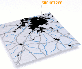 Places with similar names to Smoketree, United States - USA ::
// Smoke Tree (US)
// Soamiakatra (MG)
// Somoukdour (TD)
// Samakou Dara (SN)
// Xóm Cầu Tre (VN)
// Xóm Cái Trầu (VN)
Disclaimer :: Information on this page comes without warranty of any kind |
||
|
Where is Smoketree? Elevation and coordinates ::
Latitude (lat): 33°53'13"N Longitude (lon): 84°12'20"W
Elevation (approx.): 314m (map arrows pan, magnifying glasses zoom) |
||
|
Visiting Smoketree? Hotel/Accommodation ::
Book a hotel in Smoketree Travel Guide ::
rental cars ::
car rental offers GPS waypoint ::
download a GPX waypoint (PoI) of Smoketree for your GPS receiver
|
||