|
search place name
|
||
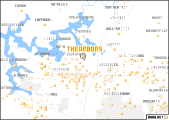
The Arbors (Georgia, United States - USA)The Arbors is a town in the Georgia region of United States - USA. An overview map of the region around The Arbors is displayed below.
regional and 3d topo map of The Arbors, United States - USA ::
The Arbors airports ::
The nearest airport is MGE - Marietta Dobbins Arb (Atlanta Nas), located 23.3 km south of The Arbors.
Other airports nearby include ATL - Hartsfield Jackson Atlanta Intl (55.3 km south), CHA - Chattanooga Lovell Fld (117.0 km north west), ANB - Anniston Metro (133.1 km south west), AND - Andersen Anderson Rgnl (176.1 km east), Nearby towns ::
Glenell (1.1km south west) //
Sturbridge (1.4km south) //
Southfork (1.5km west) //
The Woods at Colony Crossing (2.1km south west) //
Woodwind Station (2.4km south) //
Eastgate Mobile Home Park (2.4km south) //
Shadowood Mobile Home Park (2.5km south west) //
Heritage Place (2.3km west) //
Land of Lakes (3.1km south) //
Savanna Place (3.2km south) //
Stir Up Manor (3.4km south) //
Allatoona Pass (2.9km west) //
Spring Valley Mobile Home Park (3.4km south) //
Audubon Forest (3.5km south) //
Sumpter Ridge (3.6km south) //
Kingridge West (3.6km south east) //
Bascombs Springs (3.7km south east) //
The Crossroads (3.9km south) //
Tyson Estates (3.8km south west) //
Independence Walk (3.9km south east) //
Nowlin Station (4.1km south) //
Kingridge North (3.8km south east) //
Cherokee Estates (3.9km south west) //
Motes Hill (4.2km south) //
Northridge Estates (4.1km south) //
Kellogg Creek North (3.6km west) //
Kellogg Creek (3.7km west) //
Cross Creek (4.5km south) //
Victoria (4.1km north west) //
[all distances 'as the bird flies' and approximate] 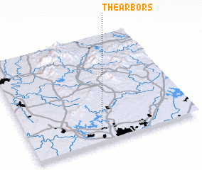 Places with similar names to The Arbors, United States - USA ::
// The Arbors (US)
Disclaimer :: Information on this page comes without warranty of any kind |
||
|
Where is The Arbors? Elevation and coordinates ::
Latitude (lat): 34°7'15"N Longitude (lon): 84°34'9"W
Elevation (approx.): 310m (map arrows pan, magnifying glasses zoom) |
||
|
Visiting The Arbors? Hotel/Accommodation ::
Book a hotel in The Arbors Travel Guide ::
rental cars ::
car rental offers GPS waypoint ::
download a GPX waypoint (PoI) of The Arbors for your GPS receiver
|
||