|
search place name
|
||
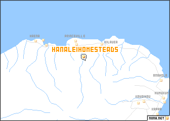
Hanalei Homesteads (Hawaii, United States - USA)Hanalei Homesteads is a town in the Hawaii region of United States - USA. An overview map of the region around Hanalei Homesteads is displayed below.
regional and 3d topo map of Hanalei Homesteads, United States - USA ::
Hanalei Homesteads airports ::
The nearest airport is LIH - Lihue, located 26.6 km south east of Hanalei Homesteads.
Other airports nearby include BKH - Barking Sands Pmrf (37.5 km south west), HDH - Dillingham (147.3 km south east), HNL - Honolulu Intl (Hickam Afb) (186.3 km south east), NGF - Kaneohe Bay Mcaf (193.5 km south east), Nearby towns ::
 Places with similar names to Hanalei Homesteads, United States - USA :: Disclaimer :: Information on this page comes without warranty of any kind |
||
|
Where is Hanalei Homesteads? Elevation and coordinates ::
Latitude (lat): 22°11'7"N Longitude (lon): 159°27'59"W
Elevation (approx.): 38m (map arrows pan, magnifying glasses zoom) |
||
|
Visiting Hanalei Homesteads? Hotel/Accommodation ::
Book a hotel in Hanalei Homesteads Travel Guide ::
rental cars ::
car rental offers GPS waypoint ::
download a GPX waypoint (PoI) of Hanalei Homesteads for your GPS receiver
|
||