|
search place name
|
||
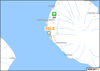
Mala (Hawaii, United States - USA)Mala is a town in the Hawaii region of United States - USA. An overview map of the region around Mala is displayed below.
regional and 3d topo map of Mala, United States - USA ::
Mala airports ::
The nearest airport is JHM - Lahania-kapalua Kapalua, located 8.2 km north of Mala.
Other airports nearby include OGG - Kahului (26.8 km east), LNY - Lanai (29.8 km south west), MKK - Molokai (51.4 km north west), HNM - Hana (70.9 km east), Nearby towns ::
Kapunakea (0.4km east) //
Puunoa (0.9km south) //
Lahaina (1.5km south) //
Kelawea (1.5km south east) //
Lunaville (2.1km south east) //
Wainee (2.6km south east) //
Crater Village (2.6km north east) //
Lahainaluna (2.7km east) //
Kaanapali (4.7km north) //
Kaanapali Landing (4.9km north) //
Puukolii (5.0km north) //
Launiupoko (5.5km south east) //
Honokowai (7.1km north) //
Mahinahina Camp (8.3km north) //
Olowalu (10.7km south east) //
Mopua (11.4km south east) //
[all distances 'as the bird flies' and approximate] 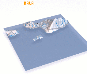 Places with similar names to Mala, United States - USA ::
Disclaimer :: Information on this page comes without warranty of any kind |
||
|
Where is Mala? Elevation and coordinates ::
Latitude (lat): 20°53'26"N Longitude (lon): 156°41'16"W
Elevation (approx.): -32768m (map arrows pan, magnifying glasses zoom) |
||
|
Visiting Mala? Hotel/Accommodation ::
Book a hotel in Mala Travel Guide ::
rental cars ::
car rental offers GPS waypoint ::
download a GPX waypoint (PoI) of Mala for your GPS receiver
|
||