|
search place name
|
||
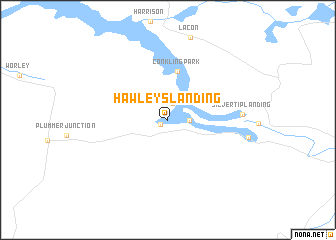
Hawleys Landing (Idaho, United States - USA)Hawleys Landing is a town in the Idaho region of United States - USA. An overview map of the region around Hawleys Landing is displayed below.
regional and 3d topo map of Hawleys Landing, United States - USA ::
Hawleys Landing airports ::
The nearest airport is SFF - Spokane Felts Fld, located 55.4 km north west of Hawleys Landing.
Other airports nearby include GEG - Spokane Intl (64.8 km north west), SKA - Spokane Fairchild Afb (72.9 km north west), YCG - Castlegar (225.1 km north), Nearby towns ::
Pedee (0.8km south west) //
Chatcolet (1.8km north) //
Rocky Point (1.6km east) //
Conkling Park (5.5km north) //
Silvertip Landing (5.7km east) //
[all distances 'as the bird flies' and approximate]  Places with similar names to Hawleys Landing, United States - USA ::
// Halls Landing (US)
// Hulse Landing (US)
Disclaimer :: Information on this page comes without warranty of any kind |
||
|
Where is Hawleys Landing? Elevation and coordinates ::
Latitude (lat): 47°21'21"N Longitude (lon): 116°46'0"W
Elevation (approx.): 645m (map arrows pan, magnifying glasses zoom) |
||
|
Visiting Hawleys Landing? Hotel/Accommodation ::
Book a hotel in Hawleys Landing Travel Guide ::
rental cars ::
car rental offers GPS waypoint ::
download a GPX waypoint (PoI) of Hawleys Landing for your GPS receiver
|
||