|
search place name
|
||
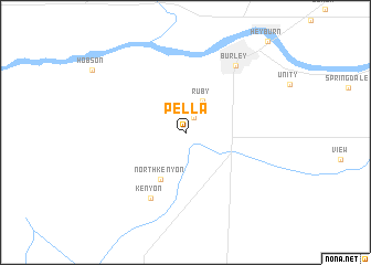
Pella (Idaho, United States - USA)Pella is a town in the Idaho region of United States - USA. An overview map of the region around Pella is displayed below.
regional and 3d topo map of Pella, United States - USA ::
Pella airports ::
The nearest airport is HIF - Ogden Hill Afb, located 215.7 km south east of Pella.
Other airports nearby include SLC - Salt Lake City Intl (243.1 km south east), Nearby towns ::
Beetville (1.6km north) //
Ruby (3.4km north) //
North Kenyon (5.1km south) //
Kenyon (7.1km south) //
Burley (7.7km north east) //
[all distances 'as the bird flies' and approximate] 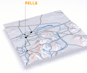 Places with similar names to Pella, United States - USA ::
Disclaimer :: Information on this page comes without warranty of any kind |
||
|
Where is Pella? Elevation and coordinates ::
Latitude (lat): 42°28'31"N Longitude (lon): 113°50'16"W
Elevation (approx.): 1288m (map arrows pan, magnifying glasses zoom) |
||
|
Visiting Pella? Hotel/Accommodation ::
Book a hotel in Pella Travel Guide ::
rental cars ::
car rental offers GPS waypoint ::
download a GPX waypoint (PoI) of Pella for your GPS receiver
|
||