|
search place name
|
||
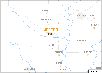
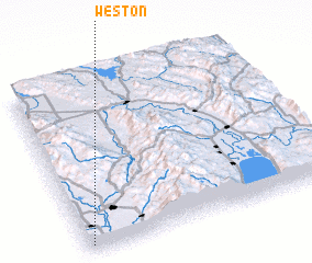
Weston (Idaho, United States - USA)Weston is a town in the Idaho region of United States - USA. An overview map of the region around Weston is displayed below.
regional and 3d topo map of Weston, United States - USA ::
Weston airports ::
The nearest airport is HIF - Ogden Hill Afb, located 101.4 km south of Weston.
Other airports nearby include SLC - Salt Lake City Intl (138.7 km south), Nearby towns ::
 Places with similar names to Weston, United States - USA ::
Disclaimer :: Information on this page comes without warranty of any kind |
||
|
Where is Weston? Elevation and coordinates ::
Latitude (lat): 42°2'14"N Longitude (lon): 111°58'43"W
Elevation (approx.): 1446m (map arrows pan, magnifying glasses zoom) |
||
|
Visiting Weston? Hotel/Accommodation ::
Book a hotel in Weston Travel Guide ::
rental cars ::
car rental offers GPS waypoint ::
download a GPX waypoint (PoI) of Weston for your GPS receiver
|
||