|
search place name
|
||
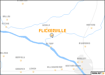
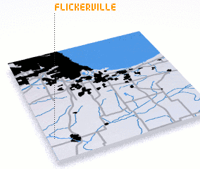
Flickerville (Illinois, United States - USA)Flickerville is a town in the Illinois region of United States - USA. An overview map of the region around Flickerville is displayed below.
regional and 3d topo map of Flickerville, United States - USA ::
Flickerville airports ::
The nearest airport is IKK - Greater Kankakee, located 18.9 km south east of Flickerville.
Other airports nearby include MDW - Chicago Midway Intl (65.1 km north), ORD - Chicago Ohare Intl (84.4 km north), GUS - Peru Grissom Arb (164.7 km east), MKE - Milwaukee General Mitchell Intl (191.9 km north), Nearby towns ::
 Places with similar names to Flickerville, United States - USA ::
// Flickerville (US)
// Valliquerville (FR)
Disclaimer :: Information on this page comes without warranty of any kind |
||
|
Where is Flickerville? Elevation and coordinates ::
Latitude (lat): 41°13'12"N Longitude (lon): 87°57'22"W
Elevation (approx.): 201m (map arrows pan, magnifying glasses zoom) |
||
|
Visiting Flickerville? Hotel/Accommodation ::
Book a hotel in Flickerville Travel Guide ::
rental cars ::
car rental offers GPS waypoint ::
download a GPX waypoint (PoI) of Flickerville for your GPS receiver
|
||