|
search place name
|
||
Turner Landing (Illinois, United States - USA)Turner Landing is a town in the Illinois region of United States - USA. An overview map of the region around Turner Landing is displayed below.
regional and 3d topo map of Turner Landing, United States - USA ::
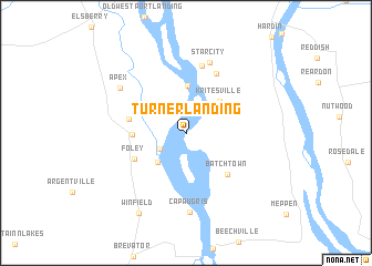
Turner Landing airports ::
The nearest airport is STL - St. Louis Lambert St Louis Intl, located 45.5 km south east of Turner Landing.
Other airports nearby include BLV - Belleville Scott Afb Midamerica (94.8 km south east), COU - Columbia Rgnl (135.1 km west), TBN - Fort Leonardwood Waynesville Rgnl Arpt At Forney Fld (194.1 km south west), Nearby towns ::
Parkers Landing (2.6km south west) //
Parkers Park (3.7km south west) //
Kritesville (4.2km north east) //
Sterling Landing (4.8km north) //
Kings Lake (4.2km west) //
Foley (4.8km south west) //
Batchtown (5.3km south east) //
Oasis (4.7km west) //
Gilead (6.5km north) //
Birch Island (6.9km north) //
Star City (7.3km north) //
Cap au Gris (7.9km south) //
Apex (6.8km north west) //
Winfield (8.9km south west) //
[all distances 'as the bird flies' and approximate] 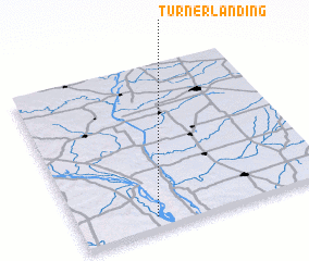 Places with similar names to Turner Landing, United States - USA ::
// Turner Landing (US)
Disclaimer :: Information on this page comes without warranty of any kind |
||
|
Where is Turner Landing? Elevation and coordinates ::
Latitude (lat): 39°4'13"N Longitude (lon): 90°41'43"W
Elevation (approx.): 138m (map arrows pan, magnifying glasses zoom) |
||
|
Visiting Turner Landing? Hotel/Accommodation ::
Book a hotel in Turner Landing Travel Guide ::
rental cars ::
car rental offers GPS waypoint ::
download a GPX waypoint (PoI) of Turner Landing for your GPS receiver
|
||