|
search place name
|
||
Belleville (Indiana, United States - USA)Belleville is a town in the Indiana region of United States - USA. An overview map of the region around Belleville is displayed below.
regional and 3d topo map of Belleville, United States - USA ::

Belleville airports ::
The nearest airport is IND - Indianapolis Intl, located 17.2 km east of Belleville.
Other airports nearby include HUF - Terre Haute Intl Hulman Fld (74.7 km west), GUS - Peru Grissom Arb (111.5 km north), CVG - Cincinnati Northern Kentucky Intl (171.7 km south east), LOU - Louisville Bowman Fld (176.0 km south east), Nearby towns ::
North Belleville (2.0km north) //
Cartersburg (3.2km north east) //
Magnetic Springs (3.7km north) //
Clayton (3.2km north west) //
Center Valley (5.3km south) //
Summit (4.3km west) //
Hazelwood (7.4km south west) //
Joppa (6.9km south east) //
Allman (8.3km south east) //
Nash (9.1km north west) //
[all distances 'as the bird flies' and approximate] 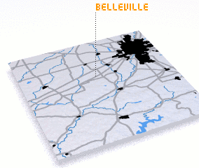 Places with similar names to Belleville, United States - USA ::
// Balaghel (ET)
// Belleville (US)
// Belleville (US)
// Bellville (US)
// Bellville (US)
// Bealville (US)
// Bellvale (US)
// Beulah Valley (US)
// Blue Valley (US)
// Baileyville (US)
Disclaimer :: Information on this page comes without warranty of any kind |
||
|
Where is Belleville? Elevation and coordinates ::
Latitude (lat): 39°40'38"N Longitude (lon): 86°29'18"W
Elevation (approx.): 270m (map arrows pan, magnifying glasses zoom) |
||
|
Visiting Belleville? Hotel/Accommodation ::
Book a hotel in Belleville Travel Guide ::
rental cars ::
car rental offers GPS waypoint ::
download a GPX waypoint (PoI) of Belleville for your GPS receiver
|
||