|
search place name
|
||
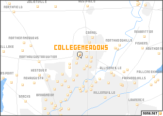
College Meadows (Indiana, United States - USA)College Meadows is a town in the Indiana region of United States - USA. An overview map of the region around College Meadows is displayed below.
regional and 3d topo map of College Meadows, United States - USA ::
College Meadows airports ::
The nearest airport is IND - Indianapolis Intl, located 27.6 km south west of College Meadows.
Other airports nearby include GUS - Peru Grissom Arb (79.2 km north), HUF - Terre Haute Intl Hulman Fld (113.6 km south west), CVG - Cincinnati Northern Kentucky Intl (160.4 km south east), DAY - James M Cox Dayton Intl (164.3 km east), Nearby towns ::
North Ridge Village (0.8km west) //
Home Place (1.0km north) //
Orchard Park (0.9km east) //
College Crest (1.4km south west) //
Echo Crest (1.9km north east) //
Sherwood Forest (2.0km south east) //
Chesterton (1.8km south east) //
Holaday Hills and Dales (1.8km east) //
Nora (2.6km south) //
Driftwood Hills (2.6km south east) //
Spring Hollow (2.5km south west) //
Spring Mill Woods (3.0km south west) //
Newark Village (3.9km north) //
Williams Creek (4.0km south) //
Ravenswood (5.3km south) //
Meridian Hills (5.2km south) //
Carmel (5.1km north) //
Greenbriar (5.0km south west) //
Glendale Heights (6.0km south east) //
Pleasant Acres (5.9km south east) //
Hoover Crest (6.0km south west) //
Shore Acres (6.6km south) //
Creekwood (6.7km south) //
Wellington (7.1km south) //
Spring Mill Estates (7.0km south) //
Dawnbury (7.5km south) //
Broad Ripple (7.6km south) //
Delaware Trails (7.1km south west) //
Allisonville (6.3km south east) //
[all distances 'as the bird flies' and approximate] 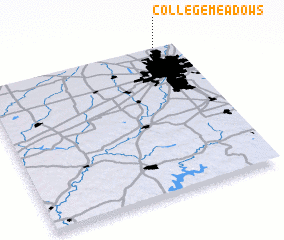 Places with similar names to College Meadows, United States - USA :: Disclaimer :: Information on this page comes without warranty of any kind |
||
|
Where is College Meadows? Elevation and coordinates ::
Latitude (lat): 39°56'7"N Longitude (lon): 86°8'25"W
Elevation (approx.): 260m (map arrows pan, magnifying glasses zoom) |
||
|
Visiting College Meadows? Hotel/Accommodation ::
Book a hotel in College Meadows Travel Guide ::
rental cars ::
car rental offers GPS waypoint ::
download a GPX waypoint (PoI) of College Meadows for your GPS receiver
|
||