|
search place name
|
||
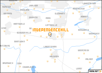
Independence Hill (Indiana, United States - USA)Independence Hill is a town in the Indiana region of United States - USA. An overview map of the region around Independence Hill is displayed below.
regional and 3d topo map of Independence Hill, United States - USA ::
Independence Hill airports ::
The nearest airport is MDW - Chicago Midway Intl, located 47.1 km north west of Independence Hill.
Other airports nearby include IKK - Greater Kankakee (60.3 km south west), ORD - Chicago Ohare Intl (71.5 km north west), GUS - Peru Grissom Arb (137.4 km south east), MKE - Milwaukee General Mitchell Intl (169.2 km north), Nearby towns ::
Lincoln Village (1.2km west) //
Southmoor Park (1.8km east) //
Lottaville (3.0km north) //
Turkey Creek Meadows (2.9km north east) //
Rolling Hill Estates (2.8km west) //
Merrillville (3.0km east) //
Chapel Manor (3.0km east) //
Liberty Park (4.9km south) //
Ross (5.7km north) //
New Elliott (4.6km north west) //
Crown Point (6.6km south) //
Green Acres (5.9km east) //
Glen Park (7.7km north) //
Wald View (8.5km south) //
Griffith (7.5km north west) //
Lake Hills (6.7km west) //
Liverpool (10.4km north east) //
[all distances 'as the bird flies' and approximate] 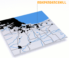 Places with similar names to Independence Hill, United States - USA :: Disclaimer :: Information on this page comes without warranty of any kind |
||
|
Where is Independence Hill? Elevation and coordinates ::
Latitude (lat): 41°28'34"N Longitude (lon): 87°22'2"W
Elevation (approx.): 212m (map arrows pan, magnifying glasses zoom) |
||
|
Visiting Independence Hill? Hotel/Accommodation ::
Book a hotel in Independence Hill Travel Guide ::
rental cars ::
car rental offers GPS waypoint ::
download a GPX waypoint (PoI) of Independence Hill for your GPS receiver
|
||