|
search place name
|
||
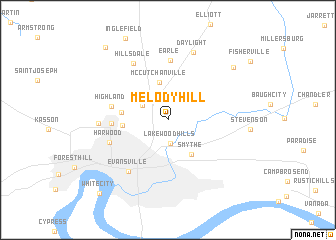
Melody Hill (Indiana, United States - USA)Melody Hill is a town in the Indiana region of United States - USA. An overview map of the region around Melody Hill is displayed below.
regional and 3d topo map of Melody Hill, United States - USA ::
Melody Hill airports ::
The nearest airport is FTK - Fort Knox Godman Aaf, located 136.3 km east of Melody Hill.
Other airports nearby include HOP - Hopkinsville Campbell Aaf (150.7 km south), HUF - Terre Haute Intl Hulman Fld (159.3 km north), LOU - Louisville Bowman Fld (163.9 km east), IND - Indianapolis Intl (215.6 km north east), Nearby towns ::
Knob Hill (0.7km north) //
Lakewood Hills (2.7km south) //
Erskine Station (2.8km north west) //
McCutchanville (4.3km north) //
Smythe (4.4km south east) //
Stringtown (4.1km west) //
Mechanicsville (4.2km west) //
Country Club Meadows (5.0km west) //
Highland (5.2km west) //
Earle (6.6km north) //
Harwood (5.7km south west) //
Evansville (6.7km south west) //
Hillsdale (7.0km north west) //
Kratzville (6.1km west) //
Daylight (7.8km north) //
Saint John (8.2km north east) //
Darmstadt (9.8km north west) //
White City (10.1km south west) //
[all distances 'as the bird flies' and approximate] 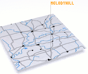 Places with similar names to Melody Hill, United States - USA ::
// Mulādhuli (BD)
Disclaimer :: Information on this page comes without warranty of any kind |
||
|
Where is Melody Hill? Elevation and coordinates ::
Latitude (lat): 38°1'34"N Longitude (lon): 87°30'57"W
Elevation (approx.): 131m (map arrows pan, magnifying glasses zoom) |
||
|
Visiting Melody Hill? Hotel/Accommodation ::
Book a hotel in Melody Hill Travel Guide ::
rental cars ::
car rental offers GPS waypoint ::
download a GPX waypoint (PoI) of Melody Hill for your GPS receiver
|
||