|
search place name
|
||
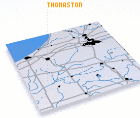
Thomaston (Indiana, United States - USA)Thomaston is a town in the Indiana region of United States - USA. An overview map of the region around Thomaston is displayed below.
regional and 3d topo map of Thomaston, United States - USA ::

Thomaston airports ::
The nearest airport is MDW - Chicago Midway Intl, located 90.4 km north west of Thomaston.
Other airports nearby include IKK - Greater Kankakee (93.0 km west), GUS - Peru Grissom Arb (98.4 km south east), ORD - Chicago Ohare Intl (112.7 km north west), IND - Indianapolis Intl (189.6 km south), Nearby towns ::
 Places with similar names to Thomaston, United States - USA ::
// Thomaston (US)
// Thomaston (US)
// Thomaston (US)
// Thomastown (US)
// Thomaston (US)
// Thomas Town (US)
// Thomastown (US)
// Thomaston (US)
// Thomastown (US)
// Thomaston (US)
Disclaimer :: Information on this page comes without warranty of any kind |
||
|
Where is Thomaston? Elevation and coordinates ::
Latitude (lat): 41°22'42"N Longitude (lon): 86°48'51"W
Elevation (approx.): 212m (map arrows pan, magnifying glasses zoom) |
||
|
Visiting Thomaston? Hotel/Accommodation ::
Book a hotel in Thomaston Travel Guide ::
rental cars ::
car rental offers GPS waypoint ::
download a GPX waypoint (PoI) of Thomaston for your GPS receiver
|
||