|
search place name
|
||
Blockton (Iowa, United States - USA)Blockton is a town in the Iowa region of United States - USA. An overview map of the region around Blockton is displayed below.
regional and 3d topo map of Blockton, United States - USA ::

Blockton airports ::
The nearest airport is DSM - Des Moines Intl, located 122.8 km north east of Blockton.
Other airports nearby include OFF - Omaha Offutt Afb (133.3 km north west), OMA - Omaha Eppley Afld (141.6 km north west), FLV - Fort Leavenworth Sherman Aaf (143.4 km south), MCI - Kansas City Intl (147.7 km south), Nearby towns ::
Athelstan (7.0km south west) //
Platteville (7.2km west) //
Maloy (8.5km north east) //
[all distances 'as the bird flies' and approximate] 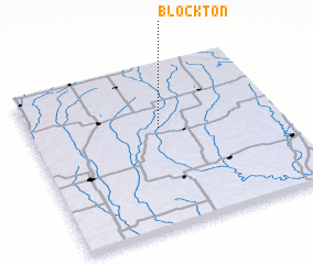 Places with similar names to Blockton, United States - USA ::
// Blackton (US)
// Bleckden (DE)
// Bullocktown (US)
// Balakhton (RU)
// Blocktown (US)
// Blacktown (US)
// Balakottunna (LK)
// Bulukatoni (UG)
// Blagdon (GB)
// Belcodène (FR)
Disclaimer :: Information on this page comes without warranty of any kind |
||
|
Where is Blockton? Elevation and coordinates ::
Latitude (lat): 40°36'56"N Longitude (lon): 94°28'37"W
Elevation (approx.): 344m (map arrows pan, magnifying glasses zoom) |
||
|
Visiting Blockton? Hotel/Accommodation ::
Book a hotel in Blockton Travel Guide ::
rental cars ::
car rental offers GPS waypoint ::
download a GPX waypoint (PoI) of Blockton for your GPS receiver
|
||