|
search place name
|
||
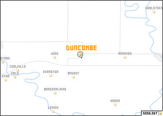
Duncombe (Iowa, United States - USA)Duncombe is a town in the Iowa region of United States - USA. An overview map of the region around Duncombe is displayed below.
regional and 3d topo map of Duncombe, United States - USA ::
Duncombe airports ::
The nearest airport is FOD - Fort Dodge Rgnl, located 18.6 km north west of Duncombe.
Other airports nearby include DSM - Des Moines Intl (107.6 km south), OMA - Omaha Eppley Afld (204.2 km south west), OFF - Omaha Offutt Afb (219.1 km south west), Nearby towns ::
Brushy (4.6km south) //
Judd (4.6km west) //
Evanston (6.6km south west) //
Border Plains (9.2km south west) //
[all distances 'as the bird flies' and approximate] 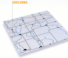 Places with similar names to Duncombe, United States - USA ::
Disclaimer :: Information on this page comes without warranty of any kind |
||
|
Where is Duncombe? Elevation and coordinates ::
Latitude (lat): 42°28'14"N Longitude (lon): 93°59'36"W
Elevation (approx.): 338m (map arrows pan, magnifying glasses zoom) |
||
|
Visiting Duncombe? Hotel/Accommodation ::
Book a hotel in Duncombe Travel Guide ::
rental cars ::
car rental offers GPS waypoint ::
download a GPX waypoint (PoI) of Duncombe for your GPS receiver
|
||