|
search place name
|
||
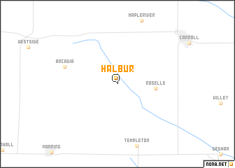
Halbur (Iowa, United States - USA)Halbur is a town in the Iowa region of United States - USA. An overview map of the region around Halbur is displayed below.
regional and 3d topo map of Halbur, United States - USA ::
Halbur airports ::
The nearest airport is FOD - Fort Dodge Rgnl, located 88.2 km north east of Halbur.
Other airports nearby include OMA - Omaha Eppley Afld (109.7 km south west), DSM - Des Moines Intl (120.7 km south east), SUX - Sioux City Sioux Gateway Col Bud Day Fld (124.8 km west), OFF - Omaha Offutt Afb (126.2 km south west), Nearby towns ::
 Places with similar names to Halbur, United States - USA ::
// Hollyberry (US)
// Hillbrow (ZA)
// Hulibāri (BD)
// Hélo Béri (NE)
// Hulabara (NG)
// Holbu-ri (KP)
// Ḩayy al Baḩr (LB)
// Haileybury (CA)
// Helbra (DE)
// Hallboro (CA)
Disclaimer :: Information on this page comes without warranty of any kind |
||
|
Where is Halbur? Elevation and coordinates ::
Latitude (lat): 42°0'25"N Longitude (lon): 94°58'11"W
Elevation (approx.): 417m (map arrows pan, magnifying glasses zoom) |
||
|
Visiting Halbur? Hotel/Accommodation ::
Book a hotel in Halbur Travel Guide ::
rental cars ::
car rental offers GPS waypoint ::
download a GPX waypoint (PoI) of Halbur for your GPS receiver
|
||