|
search place name
|
||
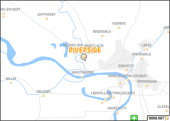
Riverside (Iowa, United States - USA)Riverside is a town in the Iowa region of United States - USA. An overview map of the region around Riverside is displayed below.
regional and 3d topo map of Riverside, United States - USA ::
Riverside airports ::
The nearest airport is SUX - Sioux City Sioux Gateway Col Bud Day Fld, located 15.2 km south east of Riverside.
Other airports nearby include OMA - Omaha Eppley Afld (143.6 km south), OFF - Omaha Offutt Afb (162.6 km south), LNK - Lincoln (186.7 km south), HON - Huron Rgnl (250.9 km north west), Nearby towns ::
North Sioux City (0.9km north) //
Mount Lucia (2.8km north east) //
Dakota Dunes (3.5km south) //
McCook Lake (3.2km north west) //
Brookdale (6.2km north east) //
South Sioux City (7.5km south east) //
Freeway Homes (8.9km south east) //
North Shore (9.3km south) //
Lake Village Trailer Court (9.3km south east) //
Yeomans (9.2km north east) //
[all distances 'as the bird flies' and approximate] 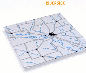 Places with similar names to Riverside, United States - USA ::
Disclaimer :: Information on this page comes without warranty of any kind |
||
|
Where is Riverside? Elevation and coordinates ::
Latitude (lat): 42°31'8"N Longitude (lon): 96°28'55"W
Elevation (approx.): 335m (map arrows pan, magnifying glasses zoom) |
||
|
Visiting Riverside? Hotel/Accommodation ::
Book a hotel in Riverside Travel Guide ::
rental cars ::
car rental offers GPS waypoint ::
download a GPX waypoint (PoI) of Riverside for your GPS receiver
|
||