|
search place name
|
||
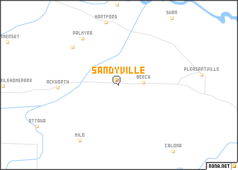
Sandyville (Iowa, United States - USA)Sandyville is a town in the Iowa region of United States - USA. An overview map of the region around Sandyville is displayed below.
regional and 3d topo map of Sandyville, United States - USA ::
Sandyville airports ::
The nearest airport is DSM - Des Moines Intl, located 29.4 km north west of Sandyville.
Other airports nearby include FOD - Fort Dodge Rgnl (147.1 km north west), Nearby towns ::
 Places with similar names to Sandyville, United States - USA ::
// Sandoval (BR)
// Sandfly (US)
// Sandoval (US)
// Santa Viola (IT)
// Santa Ovala (PT)
// Sandvoll (NO)
// Sundvoll (NO)
// Sundvoll (NO)
// Sandfell (IS)
// Sandyville (US)
Disclaimer :: Information on this page comes without warranty of any kind |
||
|
Where is Sandyville? Elevation and coordinates ::
Latitude (lat): 41°22'15"N Longitude (lon): 93°23'10"W
Elevation (approx.): 286m (map arrows pan, magnifying glasses zoom) |
||
|
Visiting Sandyville? Hotel/Accommodation ::
Book a hotel in Sandyville Travel Guide ::
rental cars ::
car rental offers GPS waypoint ::
download a GPX waypoint (PoI) of Sandyville for your GPS receiver
|
||