|
search place name
|
||
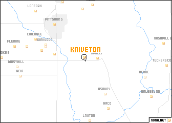
Kniveton (Kansas, United States - USA)Kniveton is a town in the Kansas region of United States - USA. An overview map of the region around Kniveton is displayed below.
regional and 3d topo map of Kniveton, United States - USA ::
Kniveton airports ::
The nearest airport is FYV - Fayetteville Drake Fld, located 153.9 km south of Kniveton.
Other airports nearby include TUL - Tulsa Intl (168.4 km south west), HRO - Harrison Boone Co (178.7 km south east), SZL - Knobnoster Whiteman Afb (182.0 km north east), FOE - Topeka Forbes Fld (200.1 km north west), Nearby towns ::
 Places with similar names to Kniveton, United States - USA ::
// Navy Town (US)
// Nuevo Edén (CO)
// Nuevo Edén (SV)
// Nuevo Edén (SV)
// Nuevo Eden (MX)
// Nuevo Edén (HN)
// Na Vit Neua (LA)
// Naughton (CA)
// Hněvotín (CZ)
// Nghĩa Tín (VN)
Disclaimer :: Information on this page comes without warranty of any kind |
||
|
Where is Kniveton? Elevation and coordinates ::
Latitude (lat): 37°20'18"N Longitude (lon): 94°38'35"W
Elevation (approx.): 275m (map arrows pan, magnifying glasses zoom) |
||
|
Visiting Kniveton? Hotel/Accommodation ::
Book a hotel in Kniveton Travel Guide ::
rental cars ::
car rental offers GPS waypoint ::
download a GPX waypoint (PoI) of Kniveton for your GPS receiver
|
||