|
search place name
|
||
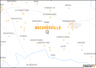
Becknerville (Kentucky, United States - USA)Becknerville is a town in the Kentucky region of United States - USA. An overview map of the region around Becknerville is displayed below.
regional and 3d topo map of Becknerville, United States - USA ::
Becknerville airports ::
The nearest airport is CVG - Cincinnati Northern Kentucky Intl, located 124.8 km north of Becknerville.
Other airports nearby include LOU - Louisville Bowman Fld (124.8 km west), LUK - Cincinnati Muni Lunken Fld (126.8 km north), FTK - Fort Knox Godman Aaf (148.9 km west), FFO - Dayton Wright Patterson Afb (207.4 km north), Nearby towns ::
Tebbs (3.5km north) //
Colby (3.6km north east) //
Hootentown (4.7km south) //
Lisletown (5.3km south) //
Locust Grove (4.9km south west) //
Pine Grove (5.1km north west) //
Boonesborough (6.5km south) //
Forest Grove (5.3km south east) //
Old Pine Grove (6.7km north) //
Lyndale (6.5km east) //
Green Fields Estates (6.9km north east) //
Flanagan (7.0km south east) //
Elkin (7.7km south east) //
Meadowbrook (7.7km north east) //
Bel Air (8.1km north east) //
[all distances 'as the bird flies' and approximate] 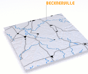 Places with similar names to Becknerville, United States - USA :: Disclaimer :: Information on this page comes without warranty of any kind |
||
|
Where is Becknerville? Elevation and coordinates ::
Latitude (lat): 37°57'59"N Longitude (lon): 84°16'46"W
Elevation (approx.): 297m (map arrows pan, magnifying glasses zoom) |
||
|
Visiting Becknerville? Hotel/Accommodation ::
Book a hotel in Becknerville Travel Guide ::
rental cars ::
car rental offers GPS waypoint ::
download a GPX waypoint (PoI) of Becknerville for your GPS receiver
|
||