|
search place name
|
||
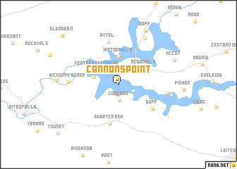
Cannons Point (Kentucky, United States - USA)Cannons Point is a town in the Kentucky region of United States - USA. An overview map of the region around Cannons Point is displayed below.
regional and 3d topo map of Cannons Point, United States - USA ::
Cannons Point airports ::
The nearest airport is FTK - Fort Knox Godman Aaf, located 56.1 km north east of Cannons Point.
Other airports nearby include LOU - Louisville Bowman Fld (100.2 km north east), HOP - Hopkinsville Campbell Aaf (137.0 km south west), BNA - Nashville Intl (163.1 km south), HUF - Terre Haute Intl Hulman Fld (220.1 km north), Nearby towns ::
Indian Valley (2.1km south east) //
Concord (2.6km south) //
Fentress McMahan (3.5km north west) //
Falling Branch (3.4km west) //
Hinton Hills (4.4km north) //
McDaniels (4.1km north east) //
Short Creek (6.3km south) //
Duff (5.7km south east) //
Axtel (6.8km north) //
Horn Back Mill (6.3km east) //
Hickory Corner (6.4km west) //
Cave Spring (8.0km north east) //
Cobblers Knob (6.9km east) //
Roff (9.1km north) //
McCoy (8.0km north east) //
Glen Dean (10.4km north west) //
[all distances 'as the bird flies' and approximate] 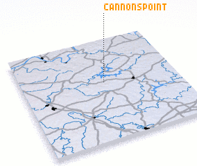 Places with similar names to Cannons Point, United States - USA :: Disclaimer :: Information on this page comes without warranty of any kind |
||
|
Where is Cannons Point? Elevation and coordinates ::
Latitude (lat): 37°35'2"N Longitude (lon): 86°27'41"W
Elevation (approx.): 177m (map arrows pan, magnifying glasses zoom) |
||
|
Visiting Cannons Point? Hotel/Accommodation ::
Book a hotel in Cannons Point Travel Guide ::
rental cars ::
car rental offers GPS waypoint ::
download a GPX waypoint (PoI) of Cannons Point for your GPS receiver
|
||