|
search place name
|
||
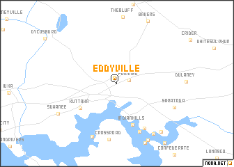
Eddyville (Kentucky, United States - USA)Eddyville is a town in the Kentucky region of United States - USA. An overview map of the region around Eddyville is displayed below.
regional and 3d topo map of Eddyville, United States - USA ::
Eddyville airports ::
The nearest airport is HOP - Hopkinsville Campbell Aaf, located 70.3 km south east of Eddyville.
Other airports nearby include BNA - Nashville Intl (165.3 km south east), MKL - Jackson Mc Kellar Sipes Rgnl (182.0 km south west), BYH - Blytheville Arkansas Intl (208.8 km south west), BLV - Belleville Scott Afb Midamerica (223.2 km north west), Nearby towns ::
Fairview (1.6km east) //
Kuttawa (6.1km south west) //
Indian Hills (7.0km south) //
Eden Bay (8.0km south east) //
Buena Vista Estates (8.2km south) //
Carmack (9.1km south) //
Palisades (9.4km south east) //
Greenacres (9.6km south east) //
[all distances 'as the bird flies' and approximate] 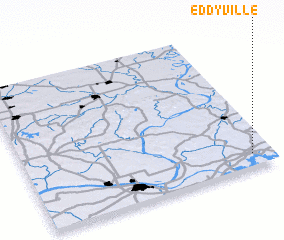 Places with similar names to Eddyville, United States - USA ::
Disclaimer :: Information on this page comes without warranty of any kind |
||
|
Where is Eddyville? Elevation and coordinates ::
Latitude (lat): 37°5'40"N Longitude (lon): 88°4'49"W
Elevation (approx.): 153m (map arrows pan, magnifying glasses zoom) |
||
|
Visiting Eddyville? Hotel/Accommodation ::
Book a hotel in Eddyville Travel Guide ::
rental cars ::
car rental offers GPS waypoint ::
download a GPX waypoint (PoI) of Eddyville for your GPS receiver
|
||