|
search place name
|
||
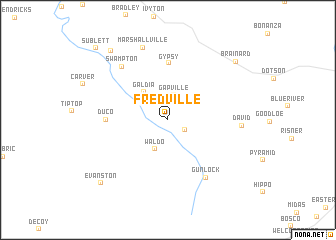
Fredville (Kentucky, United States - USA)Fredville is a town in the Kentucky region of United States - USA. An overview map of the region around Fredville is displayed below.
regional and 3d topo map of Fredville, United States - USA ::
Fredville airports ::
The nearest airport is LUK - Cincinnati Muni Lunken Fld, located 209.3 km north west of Fredville.
Other airports nearby include CVG - Cincinnati Northern Kentucky Intl (218.7 km north west), TYS - Knoxville Mc Ghee Tyson (219.3 km south west), HKY - Hickory Rgnl (250.2 km south east), Nearby towns ::
Arthurmabel (1.9km south east) //
Gapville (2.8km north) //
Waldo (3.5km south) //
Galdia (3.7km north west) //
Gypsy (6.4km north) //
Duco (5.5km west) //
Gunlock (7.3km south east) //
Swampton (7.2km north west) //
David (6.5km east) //
Marshallville (8.4km north) //
Brainard (8.9km north east) //
Royalton (9.2km north west) //
Evanston (9.2km south west) //
Sublett (10.3km north west) //
[all distances 'as the bird flies' and approximate] 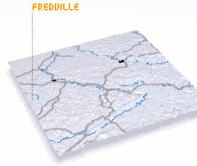 Places with similar names to Fredville, United States - USA ::
// Froideville (CH)
// Fordville (US)
// Fruitvale (US)
// Fruitvale (US)
// Fordville (US)
// Fruitville (US)
// Fort Valley (US)
// Fortville (US)
// Fruitvale (US)
// Freedville (US)
Disclaimer :: Information on this page comes without warranty of any kind |
||
|
Where is Fredville? Elevation and coordinates ::
Latitude (lat): 37°36'19"N Longitude (lon): 82°57'53"W
Elevation (approx.): 286m (map arrows pan, magnifying glasses zoom) |
||
|
Visiting Fredville? Hotel/Accommodation ::
Book a hotel in Fredville Travel Guide ::
rental cars ::
car rental offers GPS waypoint ::
download a GPX waypoint (PoI) of Fredville for your GPS receiver
|
||