|
search place name
|
||
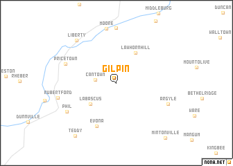
Gilpin (Kentucky, United States - USA)Gilpin is a town in the Kentucky region of United States - USA. An overview map of the region around Gilpin is displayed below.
regional and 3d topo map of Gilpin, United States - USA ::
Gilpin airports ::
The nearest airport is FTK - Fort Knox Godman Aaf, located 120.3 km north west of Gilpin.
Other airports nearby include LOU - Louisville Bowman Fld (127.9 km north west), TYS - Knoxville Mc Ghee Tyson (179.0 km south east), CVG - Cincinnati Northern Kentucky Intl (199.8 km north), BNA - Nashville Intl (203.8 km south west), Nearby towns ::
Cantown (2.7km west) //
Labascus (4.7km south west) //
Lawhorn Hill (5.4km north east) //
Evona (7.4km south) //
Pricetown (7.2km north west) //
Lanhamtown (8.8km north) //
Moore (8.8km north) //
Argyle (7.4km south east) //
Phil (7.8km south west) //
Liberty (8.5km north west) //
Teddy (10.1km south west) //
Mintonville (10.8km south east) //
[all distances 'as the bird flies' and approximate] 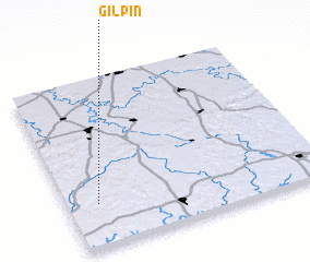 Places with similar names to Gilpin, United States - USA ::
Disclaimer :: Information on this page comes without warranty of any kind |
||
|
Where is Gilpin? Elevation and coordinates ::
Latitude (lat): 37°15'24"N Longitude (lon): 84°52'55"W
Elevation (approx.): 261m (map arrows pan, magnifying glasses zoom) |
||
|
Visiting Gilpin? Hotel/Accommodation ::
Book a hotel in Gilpin Travel Guide ::
rental cars ::
car rental offers GPS waypoint ::
download a GPX waypoint (PoI) of Gilpin for your GPS receiver
|
||