|
search place name
|
||
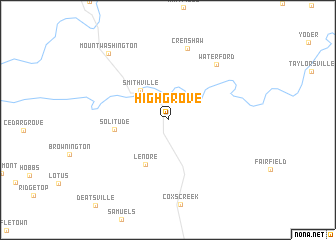
Highgrove (Kentucky, United States - USA)Highgrove is a town in the Kentucky region of United States - USA. An overview map of the region around Highgrove is displayed below.
regional and 3d topo map of Highgrove, United States - USA ::
Highgrove airports ::
The nearest airport is LOU - Louisville Bowman Fld, located 31.3 km north west of Highgrove.
Other airports nearby include FTK - Fort Knox Godman Aaf (43.5 km west), CVG - Cincinnati Northern Kentucky Intl (138.2 km north east), LUK - Cincinnati Muni Lunken Fld (155.3 km north east), IND - Indianapolis Intl (204.9 km north), Nearby towns ::
Smithville (4.1km north west) //
Lenore (5.4km south) //
Solitude (4.9km west) //
Crenshaw (8.1km north) //
Waterford (7.6km north east) //
Mount Washington (9.1km north west) //
[all distances 'as the bird flies' and approximate] 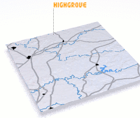
Disclaimer :: Information on this page comes without warranty of any kind |
||
|
Where is Highgrove? Elevation and coordinates ::
Latitude (lat): 37°58'59"N Longitude (lon): 85°29'11"W
Elevation (approx.): 152m (map arrows pan, magnifying glasses zoom) |
||
|
Visiting Highgrove? Hotel/Accommodation ::
Book a hotel in Highgrove Travel Guide ::
rental cars ::
car rental offers GPS waypoint ::
download a GPX waypoint (PoI) of Highgrove for your GPS receiver
|
||