|
search place name
|
||
Limaburg (Kentucky, United States - USA)Limaburg is a town in the Kentucky region of United States - USA. An overview map of the region around Limaburg is displayed below.
regional and 3d topo map of Limaburg, United States - USA ::

nearby GPS traces from timatio ::
Limaburg airports ::
The nearest airport is CVG - Cincinnati Northern Kentucky Intl, located 3.6 km north east of Limaburg.
Other airports nearby include LUK - Cincinnati Muni Lunken Fld (25.0 km east), FFO - Dayton Wright Patterson Afb (105.1 km north east), DAY - James M Cox Dayton Intl (105.9 km north), LOU - Louisville Bowman Fld (122.3 km south west), Nearby towns ::
Oakbrook (2.3km south) //
Hopeful Heights (3.3km south east) //
Burlington (3.3km west) //
Hebron (5.2km north) //
Sugartit (5.7km south) //
Florence (5.7km south east) //
Marydale (5.7km east) //
Constance (7.4km north east) //
Stringtown (7.7km north east) //
Union (8.3km south) //
Bullittsville (7.6km north west) //
Hueys Corners (8.6km south) //
Taylorsport (8.9km north) //
Anderson Ferry (8.6km north east) //
Devon (8.4km south east) //
Mount Saint Joseph (9.5km north east) //
Sunaire (9.9km north east) //
Highland Park (9.8km north east) //
Delhi Hills (10.3km north east) //
[all distances 'as the bird flies' and approximate] 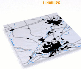 Places with similar names to Limaburg, United States - USA :: Disclaimer :: Information on this page comes without warranty of any kind |
||
|
Where is Limaburg? Elevation and coordinates ::
Latitude (lat): 39°1'12"N Longitude (lon): 84°41'14"W
Elevation (approx.): 244m (map arrows pan, magnifying glasses zoom) |
||
|
Visiting Limaburg? Hotel/Accommodation ::
Book a hotel in Limaburg Travel Guide ::
rental cars ::
car rental offers GPS waypoint ::
download a GPX waypoint (PoI) of Limaburg for your GPS receiver
|
||