|
search place name
|
||
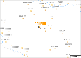
Paw Paw (Kentucky, United States - USA)Paw Paw is a town in the Kentucky region of United States - USA. An overview map of the region around Paw Paw is displayed below.
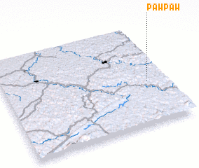
regional and 3d topo map of Paw Paw, United States - USA ::
Paw Paw airports ::
The nearest airport is HKY - Hickory Rgnl, located 199.0 km south of Paw Paw.
Other airports nearby include INT - Winston-salem Smith Reynolds (222.2 km south east), TYS - Knoxville Mc Ghee Tyson (246.9 km south west), Nearby towns ::
 Places with similar names to Paw Paw, United States - USA ::
Disclaimer :: Information on this page comes without warranty of any kind |
||
|
Where is Paw Paw? Elevation and coordinates ::
Latitude (lat): 37°26'15"N Longitude (lon): 82°6'39"W
Elevation (approx.): 350m (map arrows pan, magnifying glasses zoom) |
||
|
Visiting Paw Paw? Hotel/Accommodation ::
Book a hotel in Paw Paw Travel Guide ::
rental cars ::
car rental offers GPS waypoint ::
download a GPX waypoint (PoI) of Paw Paw for your GPS receiver
|
||