|
search place name
|
||
Pine Mountain (Kentucky, United States - USA)Pine Mountain is a town in the Kentucky region of United States - USA. An overview map of the region around Pine Mountain is displayed below.
regional and 3d topo map of Pine Mountain, United States - USA ::

Pine Mountain airports ::
The nearest airport is TYS - Knoxville Mc Ghee Tyson, located 145.7 km south west of Pine Mountain.
Other airports nearby include HKY - Hickory Rgnl (209.4 km south east), Nearby towns ::
Nolansburg (3.0km south east) //
Divide (3.1km south west) //
Laden (3.7km south) //
Big Laurel (4.7km north west) //
Dillon (5.1km south west) //
Putney (6.2km south west) //
Totz (5.7km east) //
Shields (6.8km south east) //
Gano (6.8km south east) //
Bailey Creek (7.8km south) //
River Ridge (8.0km south) //
Benito (7.2km south east) //
Short Town (8.1km south) //
Gilley (6.8km north east) //
Darkmont (8.4km south) //
Ridgeway (7.6km south east) //
Colts (8.2km south east) //
Highsplint (8.3km south east) //
Rhea (8.4km south west) //
[all distances 'as the bird flies' and approximate] 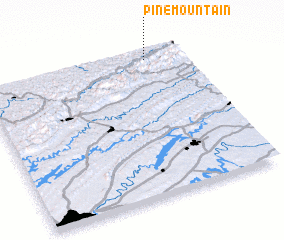 Places with similar names to Pine Mountain, United States - USA ::
// Pine Mountain (US)
// Pine Mountain (US)
// Pine Mountain (US)
// Pine Mountain (US)
// Pine Mountain (US)
// Pine Mountain (AU)
Disclaimer :: Information on this page comes without warranty of any kind |
||
|
Where is Pine Mountain? Elevation and coordinates ::
Latitude (lat): 36°56'55"N Longitude (lon): 83°10'56"W
Elevation (approx.): 539m (map arrows pan, magnifying glasses zoom) |
||
|
Visiting Pine Mountain? Hotel/Accommodation ::
Book a hotel in Pine Mountain Travel Guide ::
rental cars ::
car rental offers GPS waypoint ::
download a GPX waypoint (PoI) of Pine Mountain for your GPS receiver
|
||